MyTopo
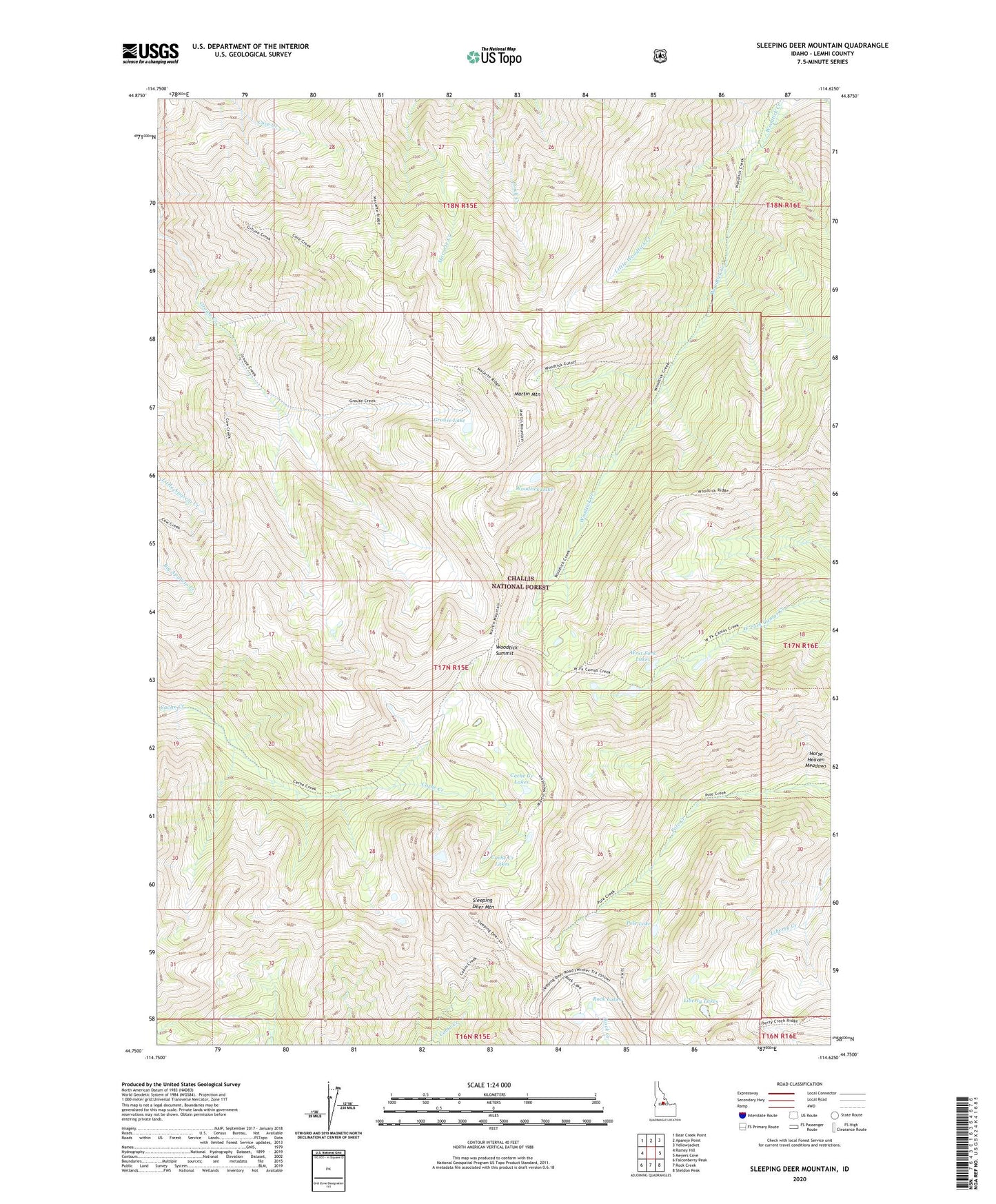
Sleeping Deer Mountain Idaho US Topo Map
Couldn't load pickup availability
Also explore the Sleeping Deer Mountain Forest Service Topo of this same quad for updated USFS data
2024 topographic map quadrangle Sleeping Deer Mountain in the state of Idaho. Scale: 1:24000. Based on the newly updated USGS 7.5' US Topo map series, this map is in the following counties: Lemhi. The map contains contour data, water features, and other items you are used to seeing on USGS maps, but also has updated roads and other features. This is the next generation of topographic maps. Printed on high-quality waterproof paper with UV fade-resistant inks.
Quads adjacent to this one:
West: Ramey Hill
Northwest: Bear Creek Point
North: Aparejo Point
Northeast: Yellowjacket
East: Meyers Cove
Southeast: Sheldon Peak
South: Rock Creek
Southwest: Falconberry Peak
This map covers the same area as the classic USGS quad with code o44114g6.
Contains the following named places: Cache Creek Cabin, Cache Creek Lakes, Grouse Lake, Horse Heaven Meadows, Liberty Lakes, Little Woodtick Creek, Martin Mountain, Pole Lake, Rock Lakes, Sleeping Deer Mountain, Sleeping Deer Recreation Site, West Fork Lakes, Woodtick Lake, Woodtick Summit