MyTopo
Tetonia Idaho US Topo Map
Couldn't load pickup availability
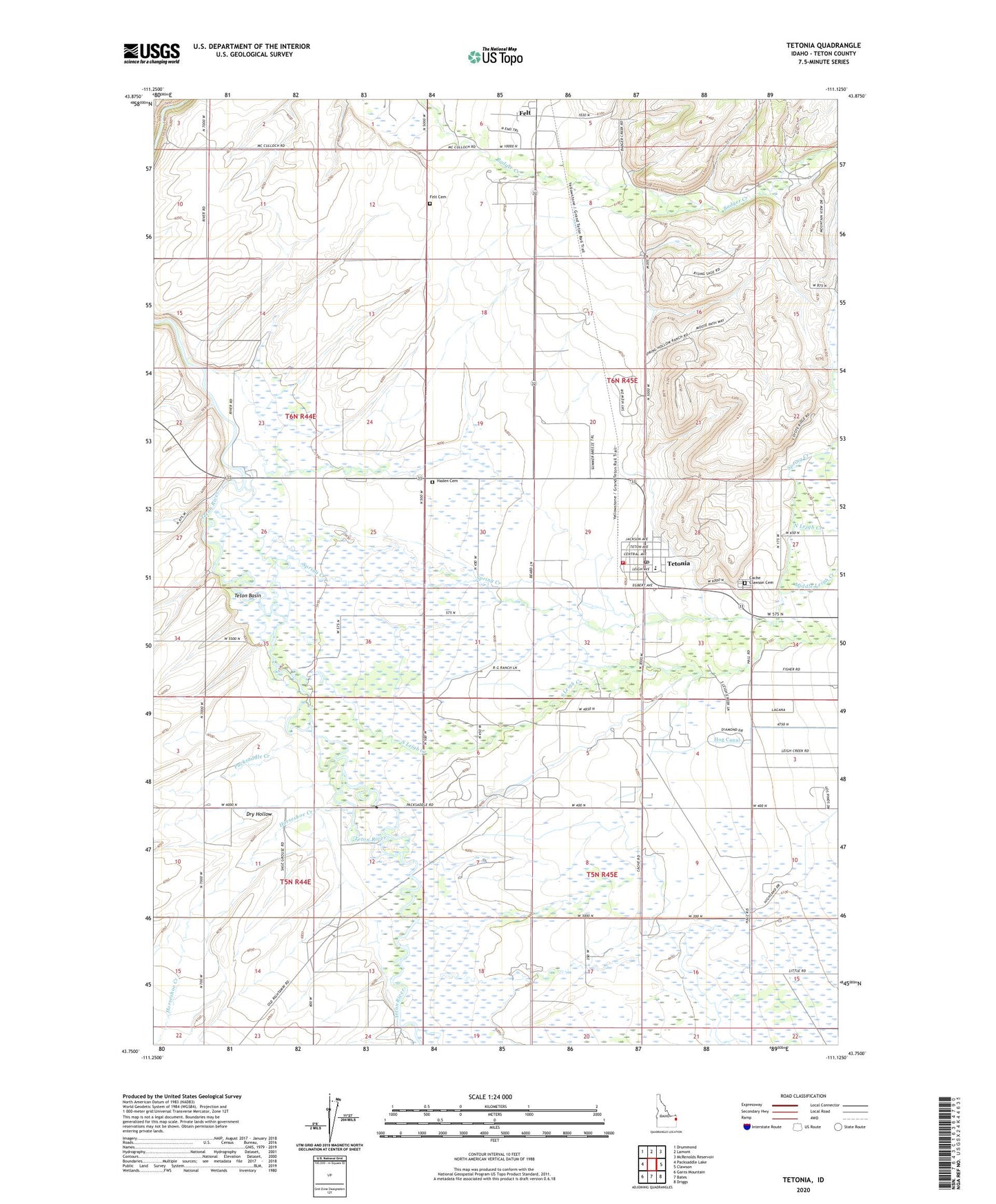
2023 topographic map quadrangle Tetonia in the state of Idaho. Scale: 1:24000. Based on the newly updated USGS 7.5' US Topo map series, this map is in the following counties: Teton. The map contains contour data, water features, and other items you are used to seeing on USGS maps, but also has updated roads and other features. This is the next generation of topographic maps. Printed on high-quality waterproof paper with UV fade-resistant inks.
Quads adjacent to this one:
West: Packsaddle Lake
Northwest: Drummond
North: Lamont
Northeast: McRenolds Reservoir
East: Clawson
Southeast: Driggs
South: Bates
Southwest: Garns Mountain
This map covers the same area as the classic USGS quad with code o43111g2.
Contains the following named places: Cache, Cache Clawson Cemetery, City of Tetonia, Dry Hollow, Felt, Felt Cemetery, Haden, Haden Cemetery, Horseshoe Creek, Middle Leigh Creek, North Leigh Creek, Packsaddle Creek, Rainer Access Area, South Leigh Creek, Spring Creek, Teton County, Teton County Fire Protection District Station 3, Tetonia, Tetonia Division, Tetonia Elementary School, Tetonia Post Office, ZIP Code: 83452