MyTopo
Triplet Butte Idaho US Topo Map
Couldn't load pickup availability
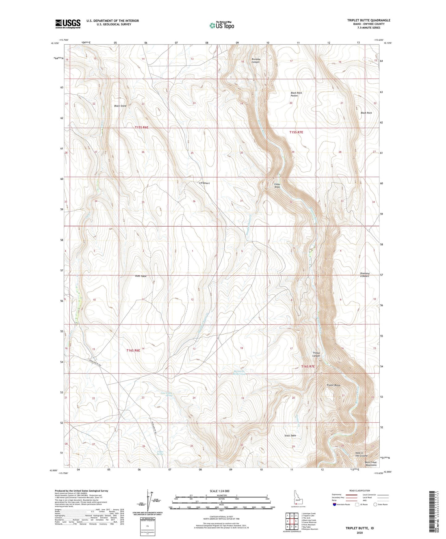
2023 topographic map quadrangle Triplet Butte in the state of Idaho. Scale: 1:24000. Based on the newly updated USGS 7.5' US Topo map series, this map is in the following counties: Owyhee. The map contains contour data, water features, and other items you are used to seeing on USGS maps, but also has updated roads and other features. This is the next generation of topographic maps. Printed on high-quality waterproof paper with UV fade-resistant inks.
Quads adjacent to this one:
West: Black Leg Creek
Northwest: Antelope Creek
North: Triguero Lake
Northeast: The Arch
East: Cowan Reservoir
Southeast: Bearpaw Mountain
South: Big Table
Southwest: Hicks Mountain
This map covers the same area as the classic USGS quad with code o42115a6.
Contains the following named places: Bernards Bedground, Black Rock, Black Rock Crossing, Black Rock Pocket, Black Stone, Cedar Draw, Cougar Creek, Deep Creek, Deep Creek Canon, Fred Hall Homestead, Hole in the Ground, Lone Willow Spring, Rizzi Table, Slaughterhouse Creek, Squaw Camp, Triplet Butte, Triplet Canyon, Triplet Spring