MyTopo
Albion South Illinois US Topo Map
Couldn't load pickup availability
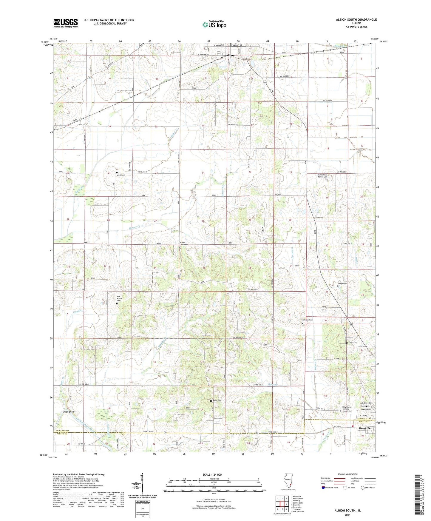
2024 topographic map quadrangle Albion South in the state of Illinois. Scale: 1:24000. Based on the newly updated USGS 7.5' US Topo map series, this map is in the following counties: Edwards, White. The map contains contour data, water features, and other items you are used to seeing on USGS maps, but also has updated roads and other features. This is the next generation of topographic maps. Printed on high-quality waterproof paper with UV fade-resistant inks.
Quads adjacent to this one:
West: Golden Gate
Northwest: Albion NW
North: Albion North
Northeast: Bone Gap
East: Grayville
Southeast: New Harmony
South: Crossville
Southwest: Centerville
This map covers the same area as the classic USGS quad with code o38088c1.
Contains the following named places: Albion East Oil Field, Albion Number 3 Election Precinct, Albion Oil Field, Birk Prairie Cemetery, Birk Prairie Church, Browns Chapel, Butter Creek, Camp Creek, Coles Cemetery, Dixon Election Precinct, Dixon School, Dixon Shoals, Dunk School, English Prairie, Flower School, French Creek Election Precinct, Gill School, Glover School, Gravet Cemetery, Grayville High School, Harper Creek, Height Shoals, Height Shoals Bridge, Holy Name Catholic Church Cemetery, Jacobs Cemetery, James Hean Family Cemetery, Johnson Cemetery, Judge School, Little Wabash Fire Protection District, Long Prairie, Mount Zion Cemetery, Mount Zion United Methodist Church, Northside Baptist Church, Oak Grove Cemetery, Olive Congregational Christian Church, Olive School, Onion Creek, Red Top, Red Top School, Ridge Baptist Church, Ridge Cemetery, Ridge School, Smith School, Stinking Creek, Vallette School, Wells Elementary School, West Cemetery, ZIP Code: 62844