MyTopo
Cypress Illinois US Topo Map
Couldn't load pickup availability
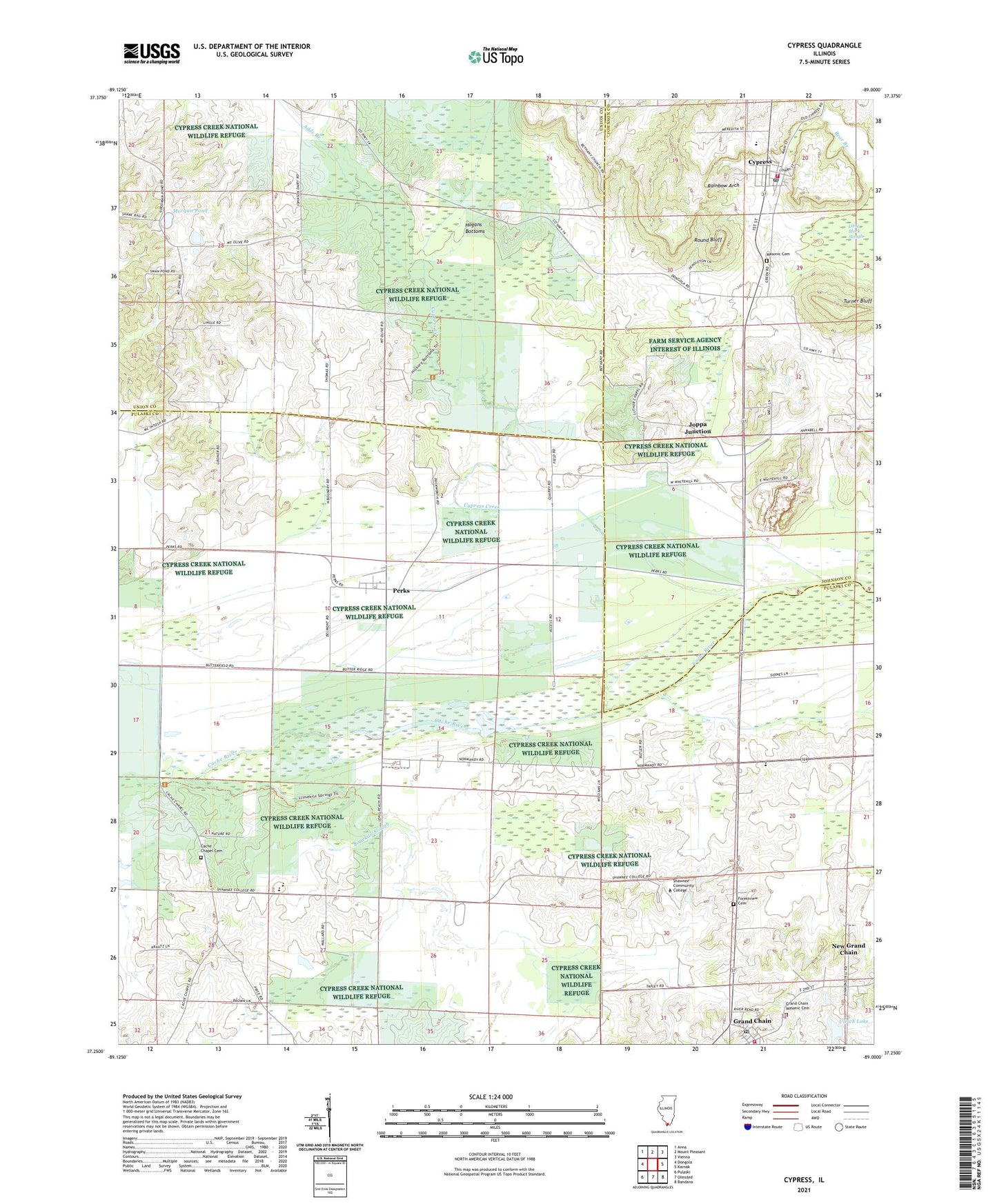
2024 topographic map quadrangle Cypress in the state of Illinois. Scale: 1:24000. Based on the newly updated USGS 7.5' US Topo map series, this map is in the following counties: Pulaski, Union, Johnson. The map contains contour data, water features, and other items you are used to seeing on USGS maps, but also has updated roads and other features. This is the next generation of topographic maps. Printed on high-quality waterproof paper with UV fade-resistant inks.
Quads adjacent to this one:
West: Dongola
Northwest: Anna
North: Mount Pleasant
Northeast: Vienna
East: Karnak
Southeast: Bandana
South: Olmsted
Southwest: Pulaski
This map covers the same area as the classic USGS quad with code o37089c1.
Contains the following named places: Adds Branch, Bethany Church, Cache Chapel, Cache Chapel Cemetery, Cache Election Precinct, Cedar Grove School, Century High School, Chapel School, Cypress, Cypress Creek, Cypress Creek Post Office, Cypress Elementary School, Cypress Post Office, Cypress Volunteer Fire Department, Dongola District 1 Election Precinct, Forestview Cemetery, Forestview School, Friendship School, Grand Chain, Grand Chain Election Precinct, Grand Chain Masonic Cemetery, Grand Chain Post Office, Grand Chain Volunteer Fire Department, Hogans Bottoms, Joppa Junction, Limekiln Slough, Luther Chapel, Maple Valley School, Masonic Cemetery, Misenheimer School, Morgan Pond, Mount Olive Church, Mount Zion Church, New Grand Chain, New Zion Church, Perks, Perks Election Precinct, Perks Post Office, Rainbow Arch, Round Bluff, Section Eight Woods Nature Preserve, Shawnee Community College, Shawnee Community College Heliport, Turner Bluff, Ulrich Lake, Ulrich Lake Dam, Village of Cypress, Village of New Grand Chain, White Hill, ZIP Code: 62923