MyTopo
Longview Illinois US Topo Map
Couldn't load pickup availability
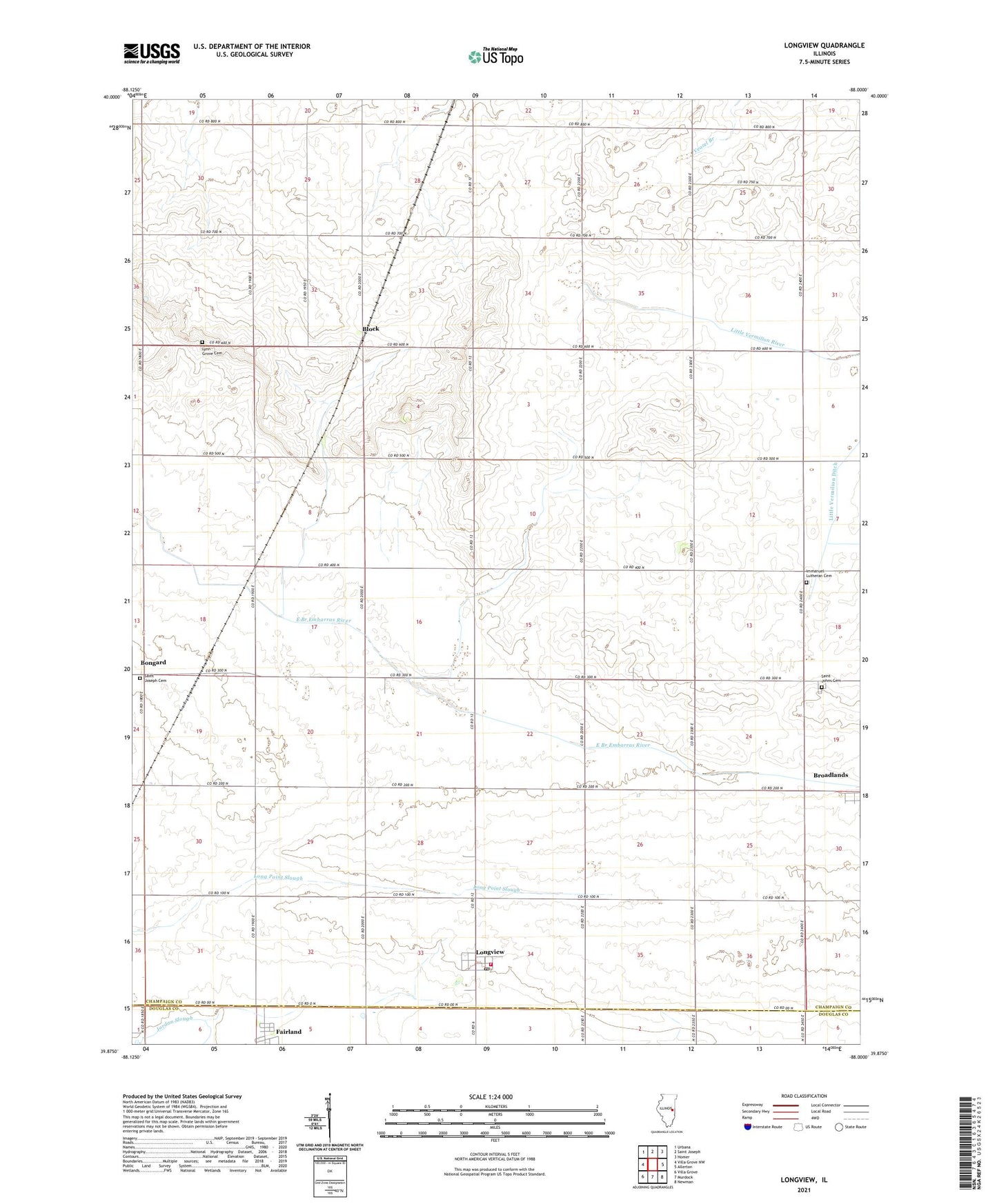
2024 topographic map quadrangle Longview in the state of Illinois. Scale: 1:24000. Based on the newly updated USGS 7.5' US Topo map series, this map is in the following counties: Champaign, Douglas. The map contains contour data, water features, and other items you are used to seeing on USGS maps, but also has updated roads and other features. This is the next generation of topographic maps. Printed on high-quality waterproof paper with UV fade-resistant inks.
Quads adjacent to this one:
West: Villa Grove NW
Northwest: Urbana
North: Saint Joseph
Northeast: Homer
East: Allerton
Southeast: Newman
South: Murdock
Southwest: Villa Grove
This map covers the same area as the classic USGS quad with code o39088h1.
Contains the following named places: Block, Bongard, Fairland, Immaculate Conception Church, Immanuel Church, Immanuel Lutheran Cemetery, Justus Airport, Little Vermilion Ditch, Longview, Longview Post Office, Longview Volunteer Fire Department, Lynn Grove Cemetery, Pleasant Hill Church, Saint John Church, Saint Johns Cemetery, Saint Joseph Cemetery, Saint Paul Church, Township of Raymond, Village of Longview, ZIP Codes: 61816, 61852, 61877