MyTopo
Prophetstown Illinois US Topo Map
Couldn't load pickup availability
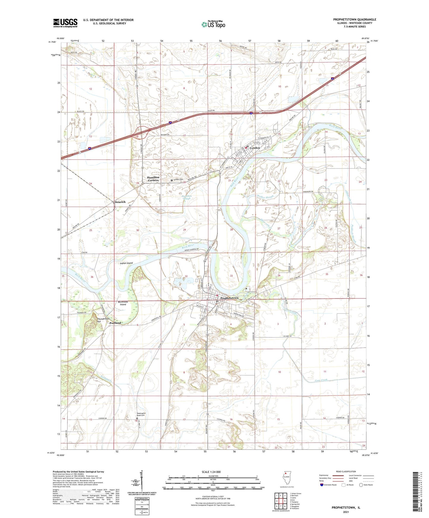
2024 topographic map quadrangle Prophetstown in the state of Illinois. Scale: 1:24000. Based on the newly updated USGS 7.5' US Topo map series, this map is in the following counties: Whiteside. The map contains contour data, water features, and other items you are used to seeing on USGS maps, but also has updated roads and other features. This is the next generation of topographic maps. Printed on high-quality waterproof paper with UV fade-resistant inks.
Quads adjacent to this one:
West: Erie
Northwest: Union Grove
North: Morrison
Northeast: Como
East: Tampico
Southeast: Yorktown
South: Hooppole
Southwest: Spring Hill
This map covers the same area as the classic USGS quad with code o41089f8.
Contains the following named places: Advent Christian Church, Benton Street School, City of Prophetstown, Coon Creek, Denrock, Doerings Port Airport, Ellsworth Creek, First Congregational Church, First Lutheran Church, Francis Club Airport, Greene School, Hackberry Slough, Hamilton Corners, Hamilton Slough, Hiland Airport, Indian Island, Jackson Street School, Langdon School, Lyndon, Lyndon Cemetery, Lyndon Post Office, Lyndon Prairie Nature Preserve, Millwoods Island, Paddock Slough, Portland, Prairie School, Pratt, Prophet Hills Country Club, Prophetstown, Prophetstown Ambulance Services, Prophetstown Elementary School, Prophetstown Fire Protection District, Prophetstown Fire Station, Prophetstown High School, Prophetstown Police Department, Prophetstown Post Office, Prophetstown State Park, River View Picnic Area, Riverside School, Saint Catherines Catholic Church, Starr Field, Thunderbolt Hill, Township of Lyndon, Township of Prophetstown, Valley Vista Estates, Village of Lyndon, Wa-bo-kie-shier Nature Trail, Walker Slough, Washington Road Cemetery, ZIP Code: 61261