MyTopo
Laurens Iowa US Topo Map
Couldn't load pickup availability
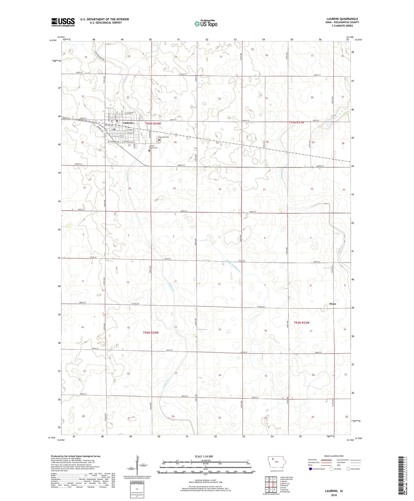
2022 topographic map quadrangle Laurens in the state of Iowa. Scale: 1:24000. Based on the newly updated USGS 7.5' US Topo map series, this map is in the following counties: Pocahontas. The map contains contour data, water features, and other items you are used to seeing on USGS maps, but also has updated roads and other features. This is the next generation of topographic maps. Printed on high-quality waterproof paper with UV fade-resistant inks.
Quads adjacent to this one:
West: Albert City
Northwest: Rush Lake West
North: Rush Lake East
Northeast: Mallard
East: Havelock
Southeast: Pocahontas
South: Fonda NE
Southwest: Varina
This map covers the same area as the classic USGS quad with code o42094g7.
Contains the following named places: Bethany Lutheran Church, Calvary Cemetery, City of Laurens, Ditch Number 14, Ditch Number 21, Laurens, Laurens - Marathon Elementary School, Laurens - Marathon High School, Laurens - Marathon Middle School, Laurens Ambulance Service, Laurens Cemetery, Laurens City Town Hall, Laurens Fire Department, Laurens Golf and Country Club, Laurens Medical Clinic, Laurens Police Department, Laurens Post Office, Laurens Public Library, Laurens Skyways Airport, Mercy Family Care Center, Northwest Recreational Park, Sacred Heart Catholic Church, Swan Lake, Township of Marshall, Township of Swan Lake, United Methodist Church, Ware, Ware Post Office, ZIP Code: 50554