MyTopo
McCausland Iowa US Topo Map
Couldn't load pickup availability
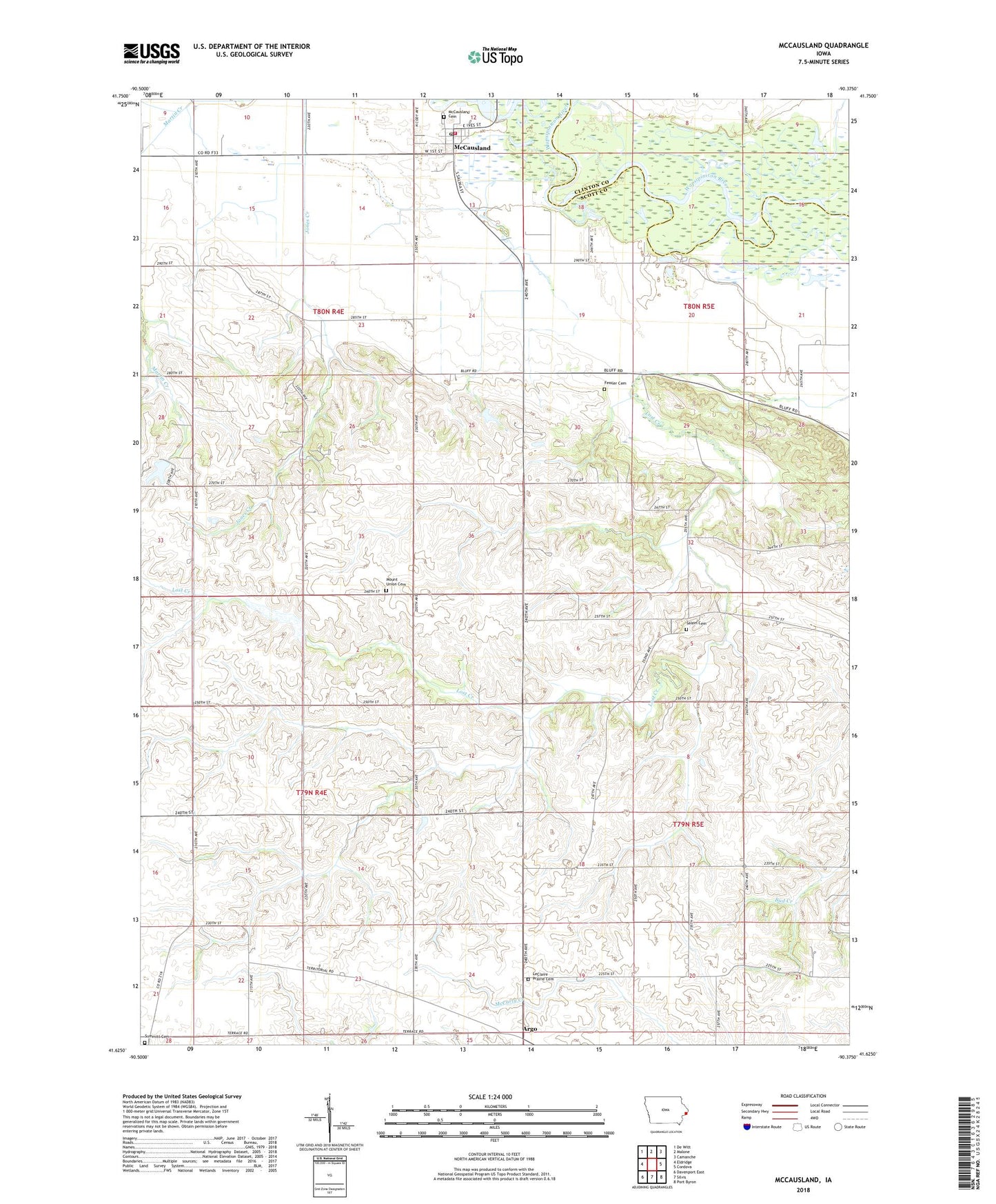
2022 topographic map quadrangle McCausland in the state of Iowa. Scale: 1:24000. Based on the newly updated USGS 7.5' US Topo map series, this map is in the following counties: Scott, Clinton. The map contains contour data, water features, and other items you are used to seeing on USGS maps, but also has updated roads and other features. This is the next generation of topographic maps. Printed on high-quality waterproof paper with UV fade-resistant inks.
Quads adjacent to this one:
West: Eldridge
Northwest: De Witt
North: Malone
Northeast: Camanche
East: Cordova
Southeast: Port Byron
South: Silvis
Southwest: Davenport East
This map covers the same area as the classic USGS quad with code o41090f4.
Contains the following named places: Argo, Argo Census Designated Place, Argo Post Office, Argo School, Buffalo Bill Cody Homestead, Buffalo Bill Homestead, City of McCausland, Criswell School, Fessler Cemetery, Kerr Post Office, KMJC-FM (Clinton), LeClaire Prairie Cemetery, Lost Grove Lake Wildlife Management Area, Lost Grove School, Maple Glenn School, McCauseland Volunteer Fire Department, McCausland, McCausland Cemetery, McCausland Methodist Church, McCausland Post Office, Mount Union Cemetery, Old Channel Lost Creek, Pleasant Hill School, Pleasant Ridge School, Quiet Valley Heliport, Rock Spring School, Salem Cemetery, South Fork Lost Creek, Summit Church, Summitt Cemetery, Township of Butler, Township of Princeton, United Church, Wapsie View School, West View School, ZIP Codes: 52753, 52758, 52768