MyTopo
Scranton Iowa US Topo Map
Couldn't load pickup availability
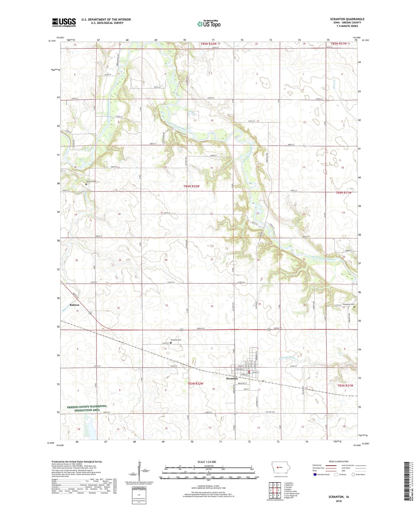
2022 topographic map quadrangle Scranton in the state of Iowa. Scale: 1:24000. Based on the newly updated USGS 7.5' US Topo map series, this map is in the following counties: Greene. The map contains contour data, water features, and other items you are used to seeing on USGS maps, but also has updated roads and other features. This is the next generation of topographic maps. Printed on high-quality waterproof paper with UV fade-resistant inks.
Quads adjacent to this one:
West: Glidden
Northwest: Lanesboro
North: Wightman
Northeast: Churdan
East: Jefferson West
Southeast: Bagley NW
South: Coon Rapids NE
Southwest: Coon Rapids North
This map covers the same area as the classic USGS quad with code o42094a5.
Contains the following named places: Brown Bridge Access, Cedar Creek, Church of Christ, City of Scranton, Dillavou Cemetery, Drainage Ditch 121, Drainage Ditch 171, Friends Church, Hobart Wildlife Area, Horseshoe Bend Wildlife Area - West Unit, Hyde County Park, Northville, Otter Creek, Raccoon River Bible Camp, Saint Paul's Catholic Church, Scranton, Scranton Cemetery, Scranton City Town Hall, Scranton Consolidated School, Scranton Fire and Rescue Unit, Scranton Post Office, Scranton Public Library, Scranton Volunteer Fire Department, Thompson Cemetery, Township of Kendrick, United Methodist Church, West Central Co-op Elevator, ZIP Code: 51462