MyTopo
Solon Iowa US Topo Map
Couldn't load pickup availability
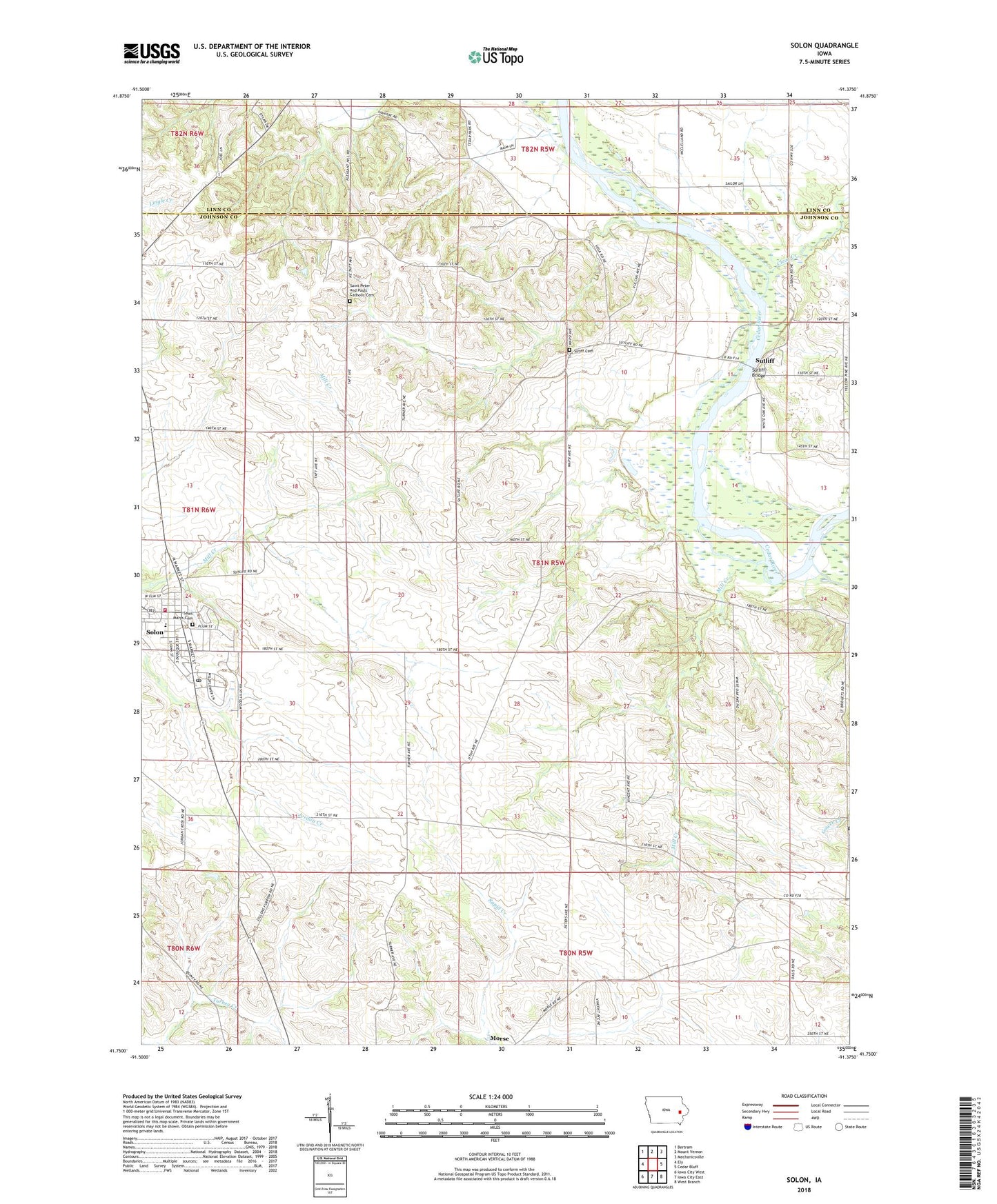
2022 topographic map quadrangle Solon in the state of Iowa. Scale: 1:24000. Based on the newly updated USGS 7.5' US Topo map series, this map is in the following counties: Johnson, Linn. The map contains contour data, water features, and other items you are used to seeing on USGS maps, but also has updated roads and other features. This is the next generation of topographic maps. Printed on high-quality waterproof paper with UV fade-resistant inks.
Quads adjacent to this one:
West: Ely
Northwest: Bertram
North: Mount Vernon
Northeast: Mechanicsville
East: Cedar Bluff
Southeast: West Branch
South: Iowa City East
Southwest: Iowa City West
This map covers the same area as the classic USGS quad with code o41091g4.
Contains the following named places: Bartlett Field, City of Solon, Clear Creek, Mill Creek, Saint Marys Cemetery, Saints Peter and Paul Cemetery, Saints Peter and Paul Church, Solon, Solon City Hall, Solon Family Practice Clinic, Solon Middle School, Solon Nursing Care Center, Solon Post Office, Solon Public Library, Solon United Methodist Church, Solon Volunteer Fire Department, Stone Academy, Sutiff Cemetery, Sutliff, Sutliff Bridge, Township of Cedar, ZIP Code: 52333