MyTopo
Almena Kansas US Topo Map
Couldn't load pickup availability
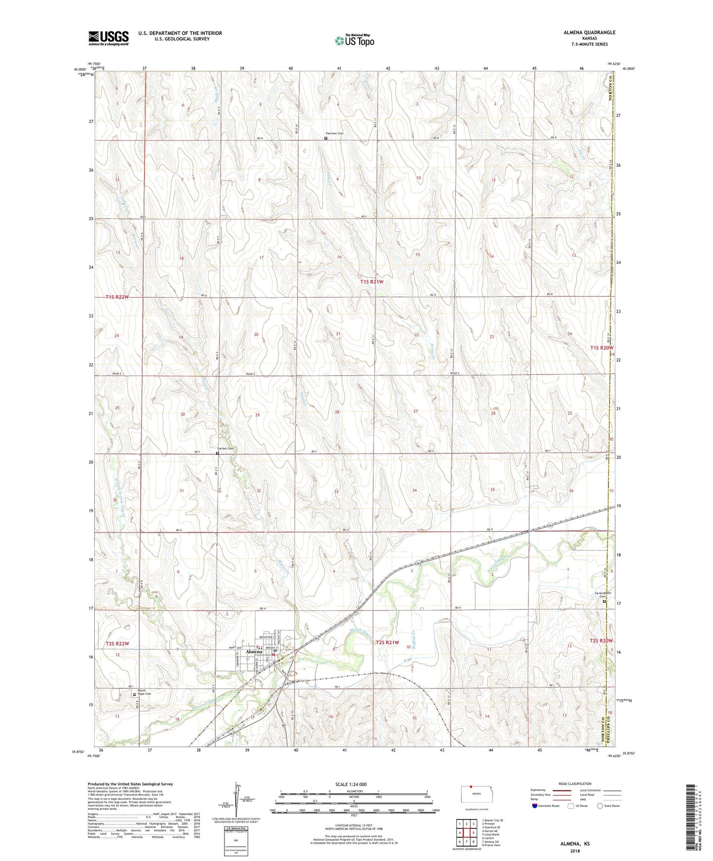
2022 topographic map quadrangle Almena in the state of Kansas. Scale: 1:24000. Based on the newly updated USGS 7.5' US Topo map series, this map is in the following counties: Norton, Phillips. The map contains contour data, water features, and other items you are used to seeing on USGS maps, but also has updated roads and other features. This is the next generation of topographic maps. Printed on high-quality waterproof paper with UV fade-resistant inks.
Quads adjacent to this one:
West: Norton NE
Northwest: Beaver City SE
North: Precept
Northeast: Stamford SE
East: Long Island
Southeast: Prairie View
South: Almena SW
Southwest: Calvert
This map covers the same area as the classic USGS quad with code o39099h6.
Contains the following named places: Almena, Almena Agri - Services Grain Elevator Number 1, Almena Area Fire Department, Almena City Hall, Almena City Lake, Almena City Library, Almena Congregational Church, Almena Elementary School, Almena Post Office, Almena United Methodist Church, Almena Wastewater Plant, Buffalo Creek, Carlson Cemetery, City of Almena, Fairview Cemetery, Fancy Creek, Farmingdale Cemetery, Horse Creek, Mount Hope Cemetery, North Fork Prairie Dog Creek, Northern Valley High School, Rayville, Sand Creek, South Fork Prairie Dog Creek, Township of Almena-District 4, Wildcat Creek, ZIP Code: 67622