MyTopo
Brewster Kansas US Topo Map
Couldn't load pickup availability
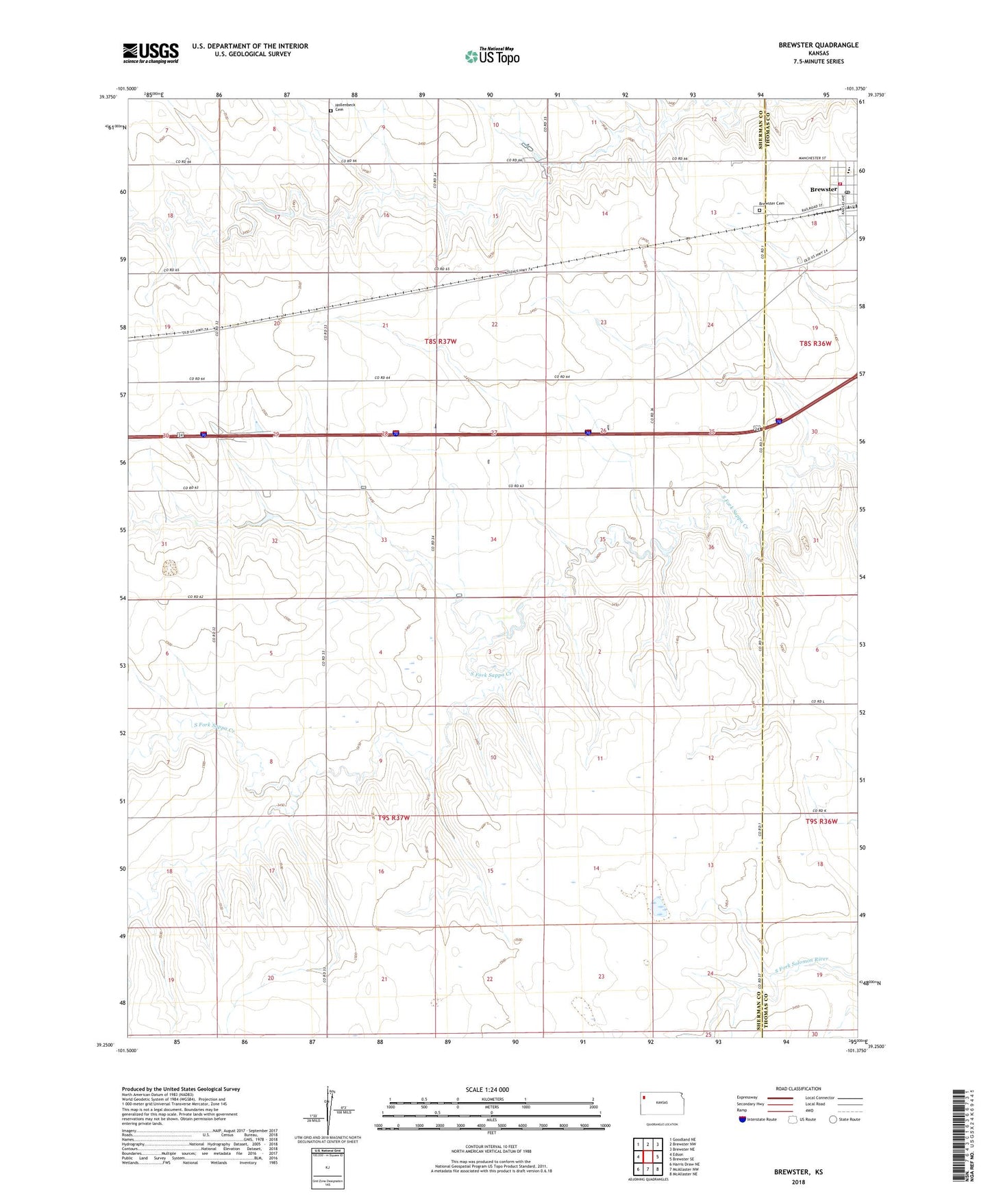
2022 topographic map quadrangle Brewster in the state of Kansas. Scale: 1:24000. Based on the newly updated USGS 7.5' US Topo map series, this map is in the following counties: Sherman, Thomas. The map contains contour data, water features, and other items you are used to seeing on USGS maps, but also has updated roads and other features. This is the next generation of topographic maps. Printed on high-quality waterproof paper with UV fade-resistant inks.
Quads adjacent to this one:
West: Edson
Northwest: Goodland NE
North: Brewster NW
Northeast: Brewster NE
East: Brewster SE
Southeast: McAllaster NE
South: McAllaster NW
Southwest: Harris Draw NE
This map covers the same area as the classic USGS quad with code o39101c4.
Contains the following named places: Brewster, Brewster Cemetery, Brewster City Marshal's Office, Brewster Elementary School, Brewster High School, Brewster Post Office, Brewster United Methodist Church, Brooks Ranch, City of Brewster, Frontier Agricultural Grain Elevator Number 4, Hollenbeck Cemetery, KGCR - FM (Brewster), Our Saviors Lutheran Church, Sherman County Fire Department - Brewster Fire Department, Thomas County Rural Fire District 5, Township of Union