MyTopo
Colby SE Kansas US Topo Map
Couldn't load pickup availability
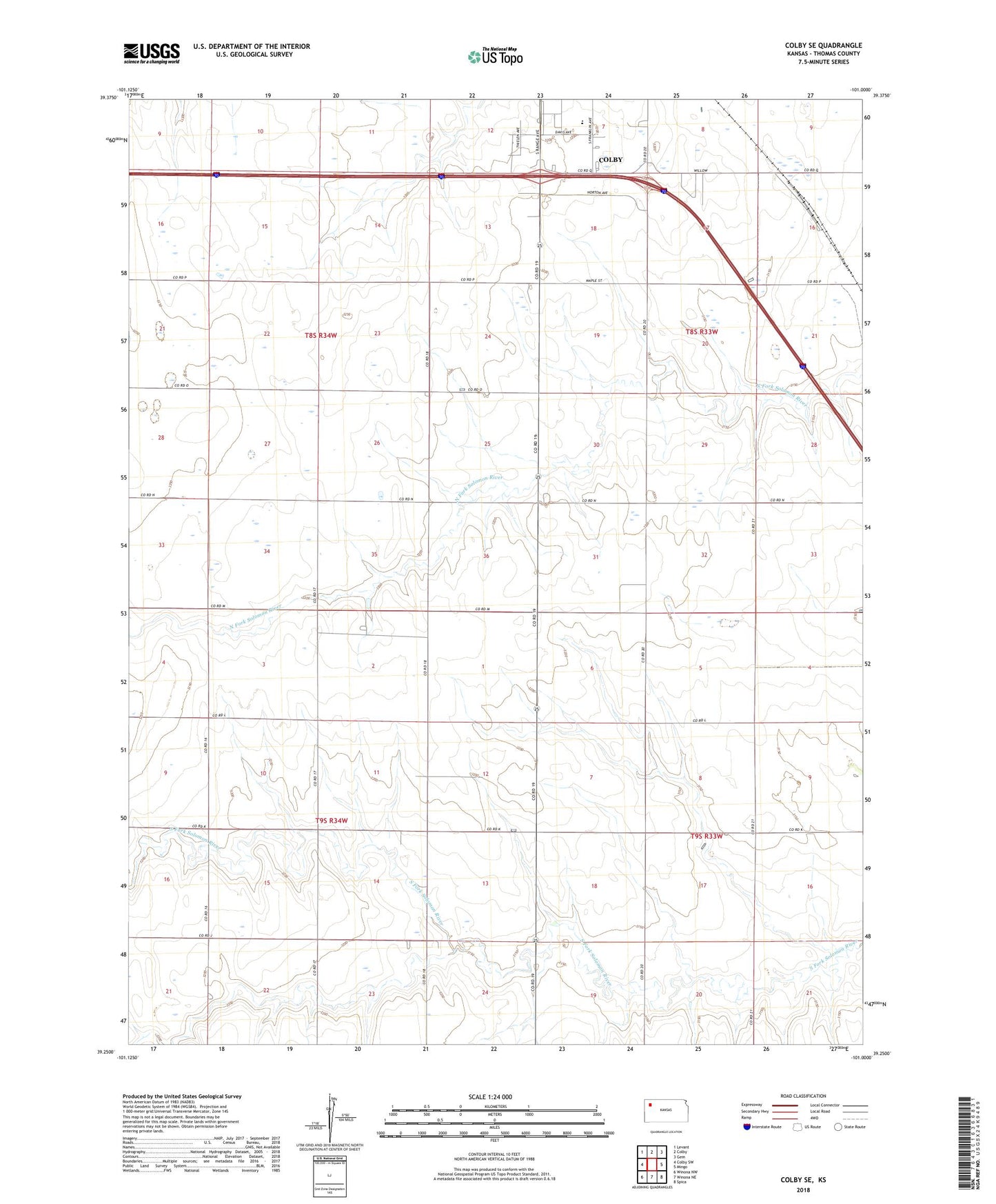
2022 topographic map quadrangle Colby SE in the state of Kansas. Scale: 1:24000. Based on the newly updated USGS 7.5' US Topo map series, this map is in the following counties: Thomas. The map contains contour data, water features, and other items you are used to seeing on USGS maps, but also has updated roads and other features. This is the next generation of topographic maps. Printed on high-quality waterproof paper with UV fade-resistant inks.
Quads adjacent to this one:
West: Colby SW
Northwest: Levant
North: Colby
Northeast: Gem
East: Mingo
Southeast: Spica
South: Winona NE
Southwest: Winona NW
This map covers the same area as the classic USGS quad with code o39101c1.
Contains the following named places: Bourquin's Recreational Vehicle Park, Center School, Colby High School, Cornerstone Agricultural Grain Elevator Number 1, Prairie Museum of Art and History, Soddy School, Star School, Thomas County, Township of Morgan