MyTopo
Collyer Kansas US Topo Map
Couldn't load pickup availability
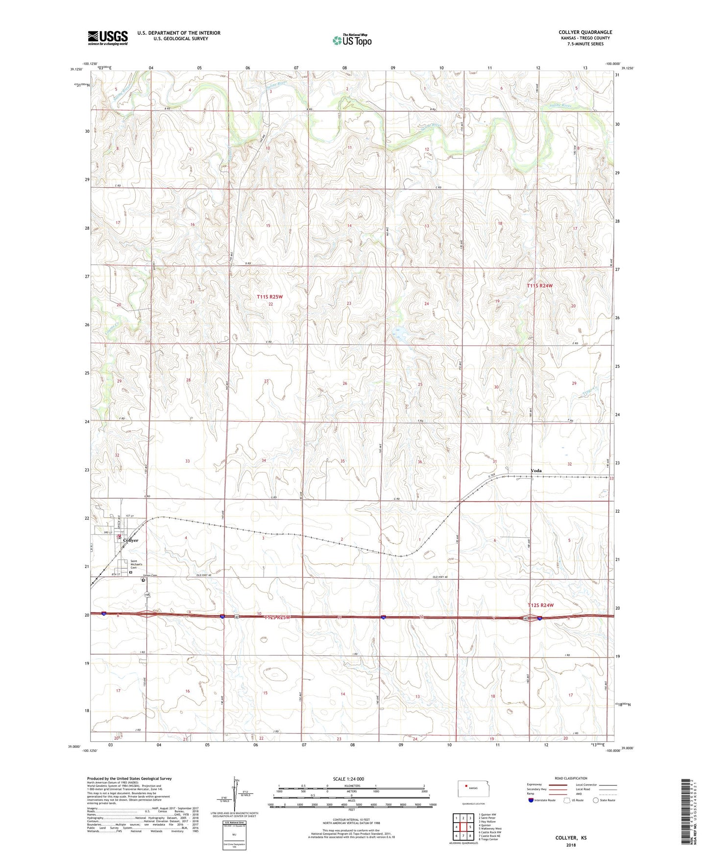
2022 topographic map quadrangle Collyer in the state of Kansas. Scale: 1:24000. Based on the newly updated USGS 7.5' US Topo map series, this map is in the following counties: Trego. The map contains contour data, water features, and other items you are used to seeing on USGS maps, but also has updated roads and other features. This is the next generation of topographic maps. Printed on high-quality waterproof paper with UV fade-resistant inks.
Quads adjacent to this one:
West: Quinter
Northwest: Quinter NW
North: Saint Peter
Northeast: Hay Hollow
East: WaKeeney West
Southeast: Trego Center
South: Castle Rock NE
Southwest: Castle Rock NW
This map covers the same area as the classic USGS quad with code o39100a1.
Contains the following named places: City of Collyer, Collyer, Collyer Fire Department, Collyer Grade School, Collyer Post Office, Collyer Wastewater Plant, Coyote Creek, Frontier Agricultural Grain Elevator Number 15, Frontier Agricultural Grain Elevator Number 24, Saint Michael Catholic Church, Saint Michael's Cemetery, Union Cemetery, Voda, ZIP Code: 67631