MyTopo
Dighton Kansas US Topo Map
Couldn't load pickup availability
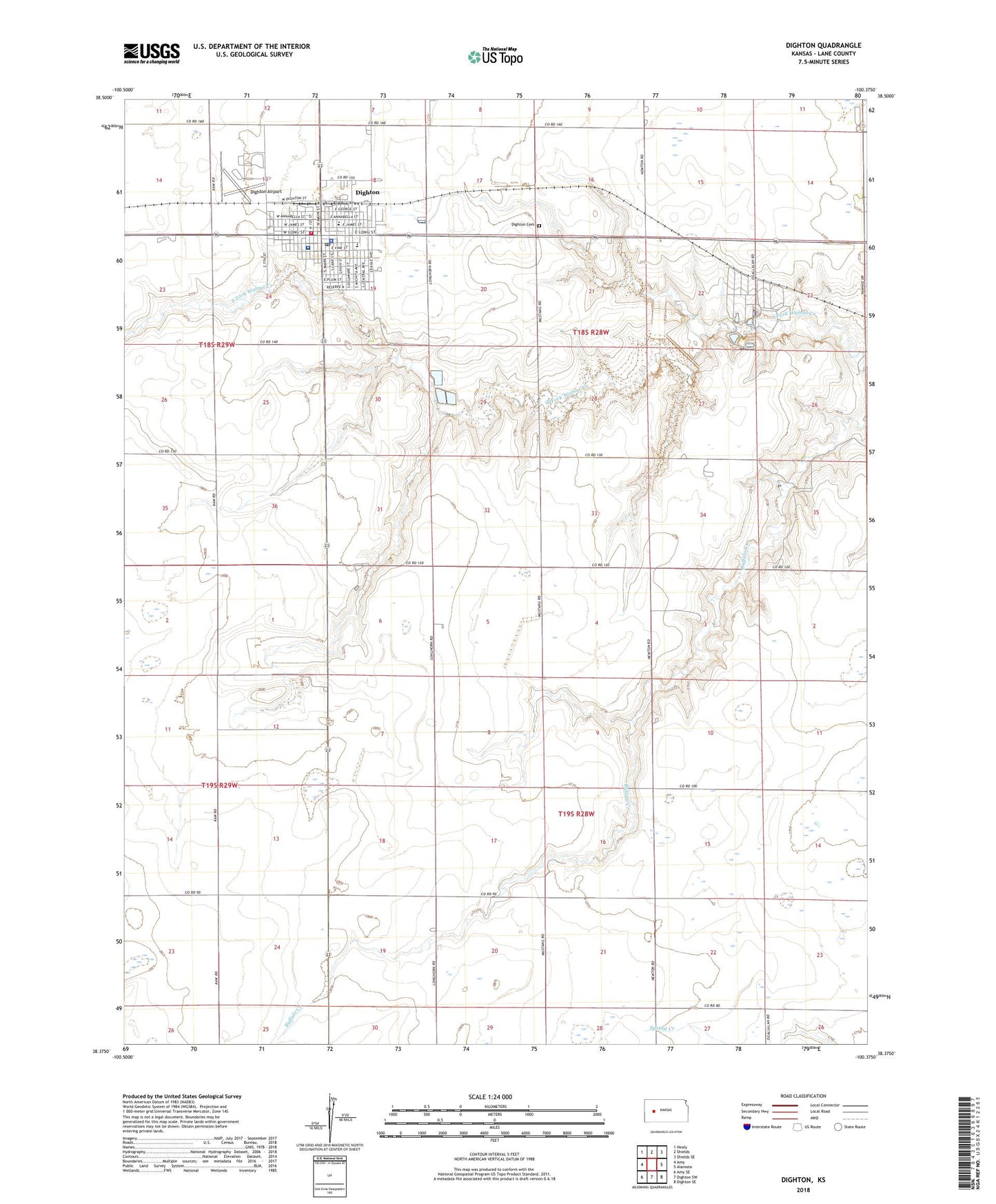
2022 topographic map quadrangle Dighton in the state of Kansas. Scale: 1:24000. Based on the newly updated USGS 7.5' US Topo map series, this map is in the following counties: Lane. The map contains contour data, water features, and other items you are used to seeing on USGS maps, but also has updated roads and other features. This is the next generation of topographic maps. Printed on high-quality waterproof paper with UV fade-resistant inks.
Quads adjacent to this one:
West: Amy
Northwest: Healy
North: Shields
Northeast: Shields SE
East: Alamota
Southeast: Dighton SE
South: Dighton SW
Southwest: Amy SE
This map covers the same area as the classic USGS quad with code o38100d4.
Contains the following named places: Bible Fellowship Church, City of Dighton, Dighton, Dighton Airport, Dighton Cemetery, Dighton City Hall, Dighton City Police Department, Dighton Elementary School, Dighton Junior / Senior High School, Dighton Post Office, Dighton United Methodist Church, Dighton Wastewater Treatment Facility, First Baptist Church, First Christian Church, Lane County, Lane County Country Club, Lane County Courthouse, Lane County Emergency Medical Services, Lane County Fairgrounds, Lane County Health Department, Lane County Historical Museum, Lane County Hospital, Lane County Jail, Lane County Library, Lane County Public Works, Lane County Rural Fire Department 1, Lane County Rural Fire District Dighton Station, Lane County Sheriff's Office, Lincoln Grade School, Saint Theresa Catholic Church, ZIP Code: 67839