MyTopo
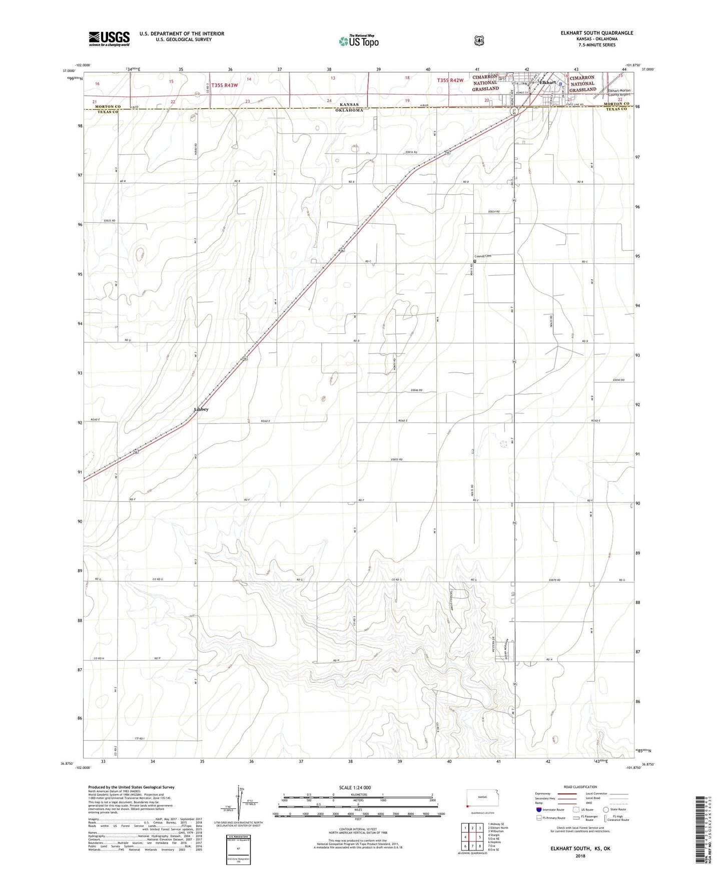
Elkhart South Kansas US Topo Map
Couldn't load pickup availability
Also explore the Elkhart South Forest Service Topo of this same quad for updated USFS data
2022 topographic map quadrangle Elkhart South in the states of Oklahoma, Kansas. Scale: 1:24000. Based on the newly updated USGS 7.5' US Topo map series, this map is in the following counties: Morton, Texas. The map contains contour data, water features, and other items you are used to seeing on USGS maps, but also has updated roads and other features. This is the next generation of topographic maps. Printed on high-quality waterproof paper with UV fade-resistant inks.
Quads adjacent to this one:
West: Sturgis
Northwest: Midway SE
North: Elkhart North
Northeast: Wilburton
East: Eva NE
Southeast: Eva SE
South: Eva
Southwest: Hopkins
Contains the following named places: Christ Lutheran Church, Cosmos Cemetery, Elkhart City Recreational Vehicle Park, Elkhart Police Department, Hillcrest Southern Baptist Church, Libbey, Morton County Courthouse, Morton County Jail, Morton County Sheriff's Office, Point Rock Golf Club, Saint Joan of Arc Catholic Church