MyTopo
Fort Larned Kansas US Topo Map
Couldn't load pickup availability
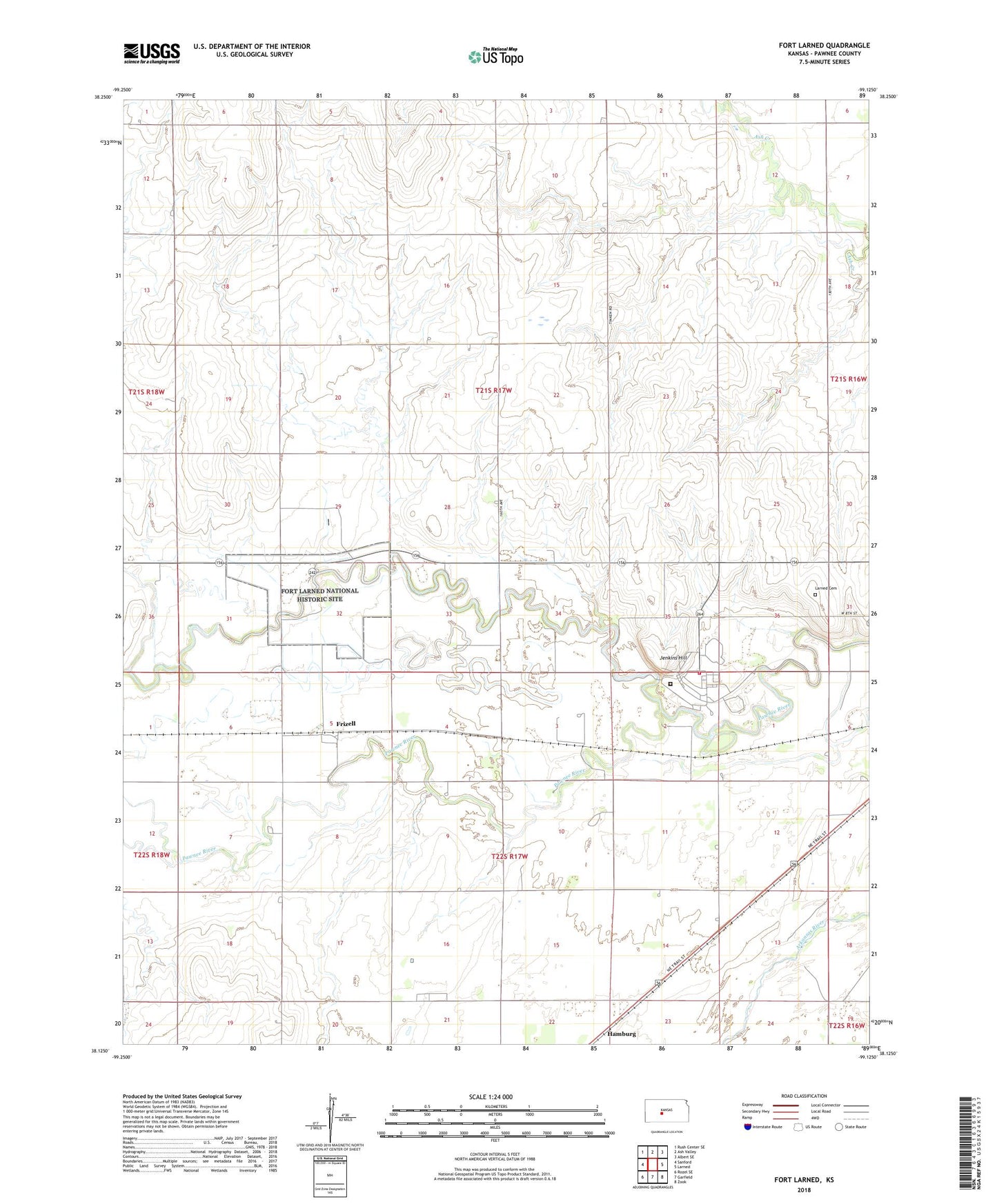
2022 topographic map quadrangle Fort Larned in the state of Kansas. Scale: 1:24000. Based on the newly updated USGS 7.5' US Topo map series, this map is in the following counties: Pawnee. The map contains contour data, water features, and other items you are used to seeing on USGS maps, but also has updated roads and other features. This is the next generation of topographic maps. Printed on high-quality waterproof paper with UV fade-resistant inks.
Quads adjacent to this one:
West: Sanford
Northwest: Rush Center SE
North: Ash Valley
Northeast: Albert SE
East: Larned
Southeast: Zook
South: Garfield
Southwest: Rozel SE
This map covers the same area as the classic USGS quad with code o38099b2.
Contains the following named places: Camp Pawnee, Fairfield Grange Hall, Fort Larned National Historic Site, Frizell, Hamburg, Jenkins Hill, Larned Cemetery, Larned Correctional Mental Health Facility, Larned Juvenile Correctional Facility, Larned State Hospital, Larned State Hospital Fire Department, Pawnee County, Santa Fe Trail Center, Santa Fe Trail Center Research Library, Sawmill Creek, Township of Pawnee, Township of Santa Fe