MyTopo
Goodland Kansas US Topo Map
Couldn't load pickup availability
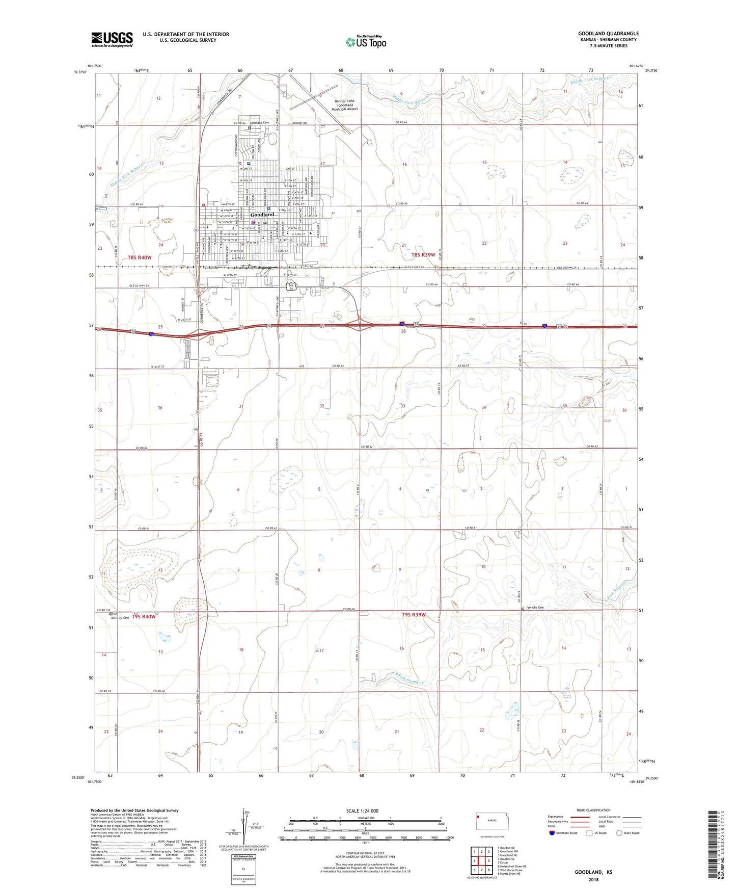
2022 topographic map quadrangle Goodland in the state of Kansas. Scale: 1:24000. Based on the newly updated USGS 7.5' US Topo map series, this map is in the following counties: Sherman. The map contains contour data, water features, and other items you are used to seeing on USGS maps, but also has updated roads and other features. This is the next generation of topographic maps. Printed on high-quality waterproof paper with UV fade-resistant inks.
Quads adjacent to this one:
West: Ruleton SE
Northwest: Ruleton NE
North: Goodland NW
Northeast: Goodland NE
East: Edson
Southeast: Harris Draw NE
South: Wild Horse Draw
Southwest: Horsethief Draw NE
This map covers the same area as the classic USGS quad with code o39101c6.
Contains the following named places: Airport Industrial Park, Bible Baptist Church, Calvary Gospel Church, Central Elementary School, City of Goodland, Emmanuel Lutheran Church, Ennis - Handy House, First Baptist Church of Goodland, First Christian Church, First United Methodist Church, Fortmeyer Airport, Frerichs Cemetery, Frontier Agricultural Grain Elevator Number 5, Goodland, Goodland Bible Church, Goodland Cemetery, Goodland Church of Christ, Goodland Church of the Nazarene, Goodland City Hall, Goodland Fire Department, Goodland Industrial Park, Goodland Junior / Senior High School, Goodland Kampgrounds of America Kampground, Goodland Municipal Power Plant, Goodland Police Department, Goodland Post Office, Goodland Public Library, Goodland Regional Medical Center, Goodland Seventh Day Adventist Church, Grant Junior High School, Gulick Park, Harvest Evangelical Free Church, High Plains Museum, Iglesia del Dios Vivo, Itasca, Kansas Highway Patrol Goodland Zone Office, Kingdom Hall of Jehovah's Witnesses, Mid - America Camp Inn, North Elementary School, Northwest Kansas Emergency Medical Services, Northwest Kansas Technical College, Our Lady of Perpetual Help Catholic Church, Promise Land Baptist Church, Renner Field /Goodland Municipal Airport, Saint Paul's Episcopal Church, Scoular Company Grain Elevator Number 5, Sherman County, Sherman County Convention and Visitors Bureau, Sherman County Courthouse, Sherman County Fairgrounds, Sherman County Fairgrounds Recreational Vehicle Park, Sherman County Public Health Department, Sherman County Rural Fire Department, Sherman County Sheriff's Office, Sherman County Speedway, Steever Park, Steever Water Park, Township of Itasca, West Elementary School, Whisler Cemetery, Wickwar Feedlot, Word of Life Foursquare Church