MyTopo
Haviland Kansas US Topo Map
Couldn't load pickup availability
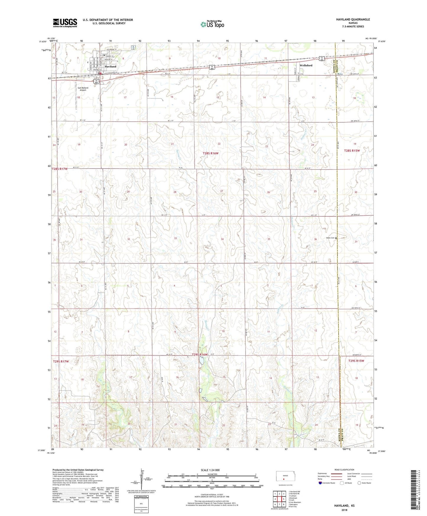
2022 topographic map quadrangle Haviland in the state of Kansas. Scale: 1:24000. Based on the newly updated USGS 7.5' US Topo map series, this map is in the following counties: Kiowa, Pratt. The map contains contour data, water features, and other items you are used to seeing on USGS maps, but also has updated roads and other features. This is the next generation of topographic maps. Printed on high-quality waterproof paper with UV fade-resistant inks.
Quads adjacent to this one:
West: Brenham
Northwest: Haviland NW
North: Haviland NE
Northeast: Cullison
East: Croft
Southeast: Sun City
South: Belvidere
Southwest: Iron Mountain
This map covers the same area as the classic USGS quad with code o37099e1.
Contains the following named places: Barclay College, Barclay College Broadhurst Student Center, Barclay College Coppock Hall, Barclay College Hockett Auditorium, Barclay College Jackson Hall, Barclay College Lemmons Hall, Barclay College Phillips Hall, Barclay College Worden Memorial Library, Boles Cemetery, City of Haviland, Farmers Co - Operative Grain Elevator Number 1, Gail Ballard Airport, Haviland, Haviland City Hall, Haviland Elementary School, Haviland Friends Church, Haviland High School, Haviland Post Office, Haviland United Methodist Church, Haviland Volunteer Fire Department, Haviland Wastewater Treatment Facility, Kiowa County Library, Township of Wellsford, Wellsford