MyTopo
Johnson West Kansas US Topo Map
Couldn't load pickup availability
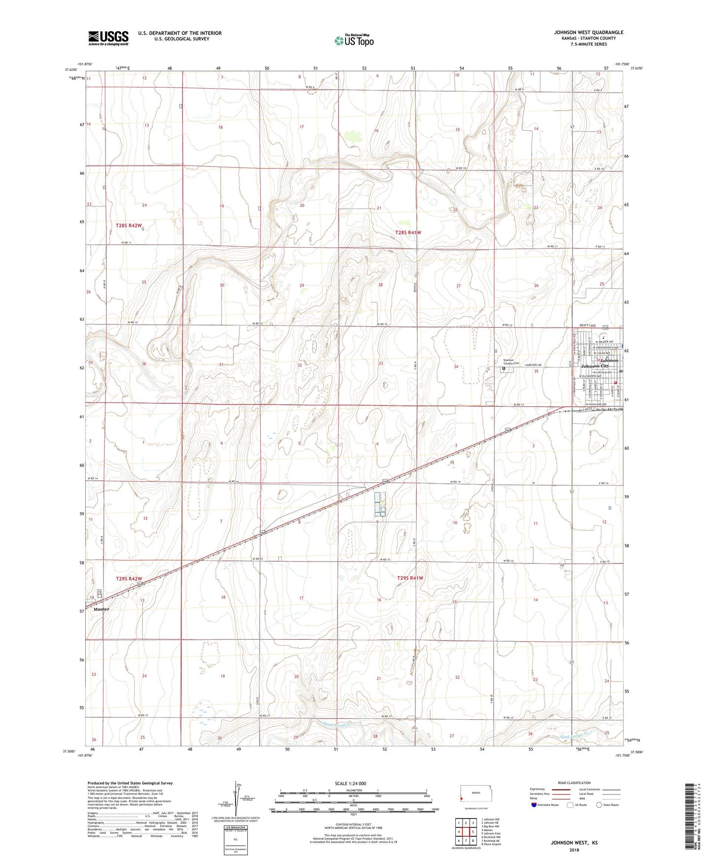
2022 topographic map quadrangle Johnson West in the state of Kansas. Scale: 1:24000. Based on the newly updated USGS 7.5' US Topo map series, this map is in the following counties: Stanton. The map contains contour data, water features, and other items you are used to seeing on USGS maps, but also has updated roads and other features. This is the next generation of topographic maps. Printed on high-quality waterproof paper with UV fade-resistant inks.
Quads adjacent to this one:
West: Manter
Northwest: Johnson NW
North: Johnson NE
Northeast: Big Bow NW
East: Johnson East
Southeast: Shore Airport
South: Richfield NE
Southwest: Richfield NW
This map covers the same area as the classic USGS quad with code o37101e7.
Contains the following named places: Cockrum Airport, Faith Baptist Church, First Baptist Church, First United Methodist Church, Johnson, Johnson City Hall, Johnson City Municipal Power Plant, Johnson Post Office, Manter Wastewater Plant, Stanton County, Stanton County Cemetery, Stanton County Courthouse, Stanton County Elementary School, Stanton County Emergency Medical Services, Stanton County Fire and Rescue Station, Stanton County Health Department, Stanton County Hospital, Stanton County Junior / Senior High School, Stanton County Middle School, Stanton County Road Department, Township of Stanton