MyTopo
Kinsley Kansas US Topo Map
Couldn't load pickup availability
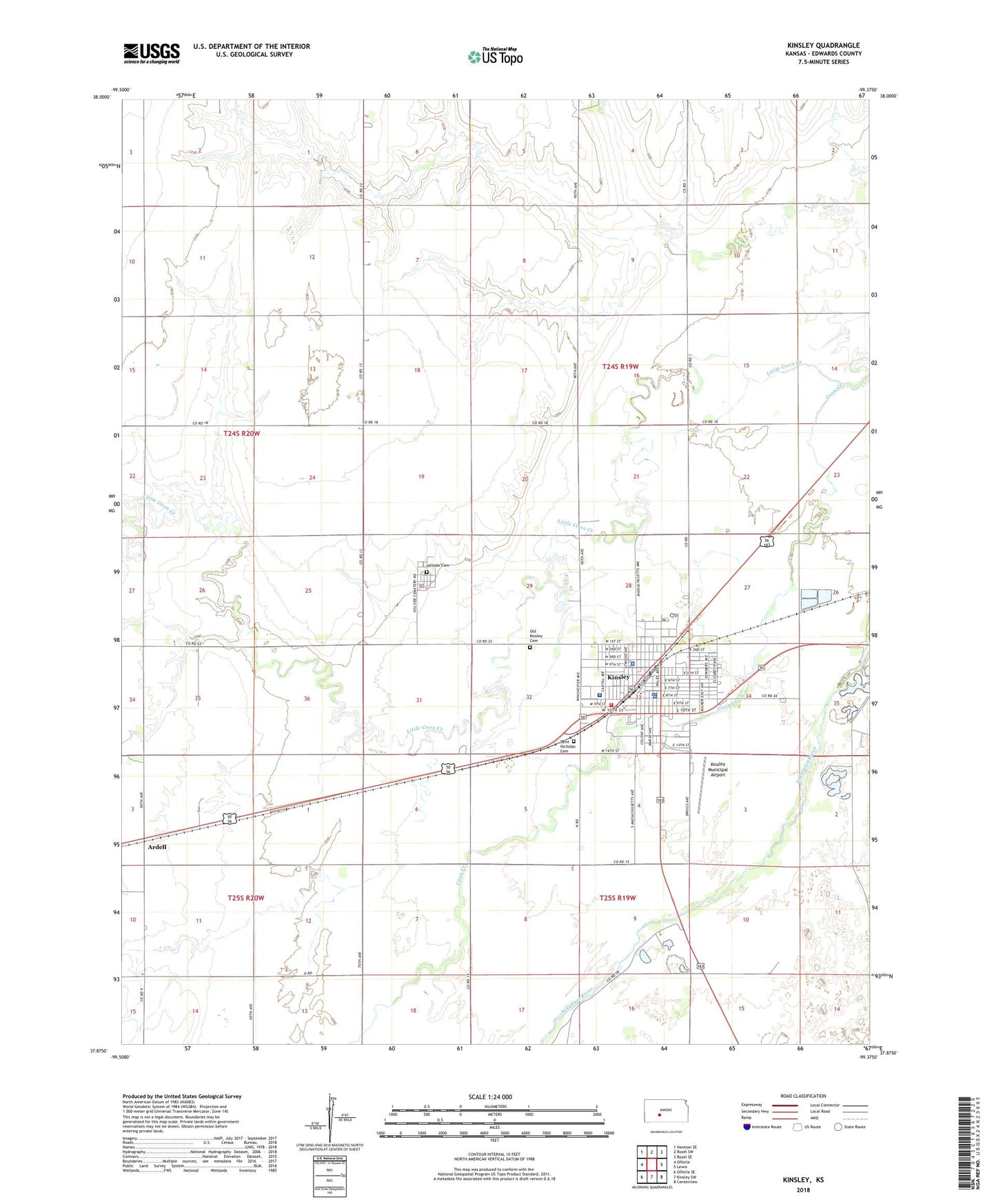
2022 topographic map quadrangle Kinsley in the state of Kansas. Scale: 1:24000. Based on the newly updated USGS 7.5' US Topo map series, this map is in the following counties: Edwards. The map contains contour data, water features, and other items you are used to seeing on USGS maps, but also has updated roads and other features. This is the next generation of topographic maps. Printed on high-quality waterproof paper with UV fade-resistant inks.
Quads adjacent to this one:
West: Offerle
Northwest: Hanston SE
North: Rozel SW
Northeast: Rozel SE
East: Lewis
Southeast: Centerview
South: Kinsley SW
Southwest: Offerle SE
This map covers the same area as the classic USGS quad with code o37099h4.
Contains the following named places: Allison Memorial Community and Youth Center, Ardell, City of Kinsley, Congregational United Church of Christ, Crossroads Victory Lighthouse Assembly of God Church, Edwards County Chamber of Commerce, Edwards County Courthouse, Edwards County Fairgrounds, Edwards County Health Department, Edwards County Historical Society Museum, Edwards County Jail, Edwards County Medical Center, Edwards County Sheriff's Office, First Christian Church, Four Aces Recreational Vehicle Park, Hillside Cemetery, Kinsley, Kinsley City Hall, Kinsley Country Club, Kinsley Fire Department, Kinsley Junior / Senior High School, Kinsley Library, Kinsley Municipal Airport, Kinsley Police Department, Kinsley Post Office, Kinsley Senior High School, Kinsley United Methodist Church, Kinsley Wastewater Plant, Little Coon Creek, Old Kinsley Cemetery, Our Redeemer Lutheran Church, Saint Nicholas Catholic Church, Saint Nicholas Cemetery, Saint Nicholas Elementary School, The Palace Theatre, The Pink Building, Township of Kinsley, ZIP Code: 67547