MyTopo
Kiowa Kansas US Topo Map
Couldn't load pickup availability
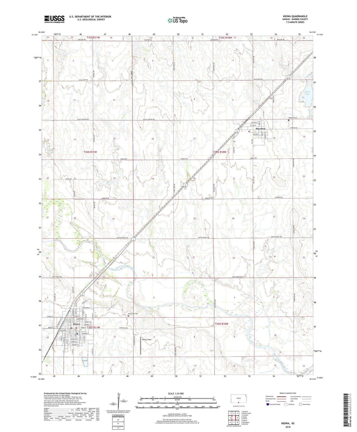
2022 topographic map quadrangle Kiowa in the state of Kansas. Scale: 1:24000. Based on the newly updated USGS 7.5' US Topo map series, this map is in the following counties: Barber. The map contains contour data, water features, and other items you are used to seeing on USGS maps, but also has updated roads and other features. This is the next generation of topographic maps. Printed on high-quality waterproof paper with UV fade-resistant inks.
Quads adjacent to this one:
West: Stubbs
Northwest: Gerlane
North: Sharon South
Northeast: Crisfield
East: Corwin
Southeast: Amorita
South: Burlington
Southwest: Capron
This map covers the same area as the classic USGS quad with code o37098a4.
Contains the following named places: Apostolic Christian Church, Barber County Ambulance Service, City of Hazelton, City of Kiowa, Congregational United Church, Farney Field, Hazelton, Hazelton Fire Department, Hazelton Wastewater Treatment Facility, Kiowa, Kiowa Airport, Kiowa City Hall, Kiowa Community Center, Kiowa District Hospital, Kiowa Fire Department, Kiowa Historical Society, Kiowa Police Department, Kiowa Post Office, Kiowa Public Library, Kiowa Southern Baptist Church, Kiowa United Methodist Church, Kiowa Wastewater Plant, Lone Tree Canyon, Riverview Cemetery, Rosehill Cemetery, Saint John the Apostle Catholic Church, South Barber 7 - 12 School, South Barber Elementary School, Spicer Lake, Township of Hazelton, Township of Kiowa, ZIP Code: 67061