MyTopo
Lakin Kansas US Topo Map
Couldn't load pickup availability
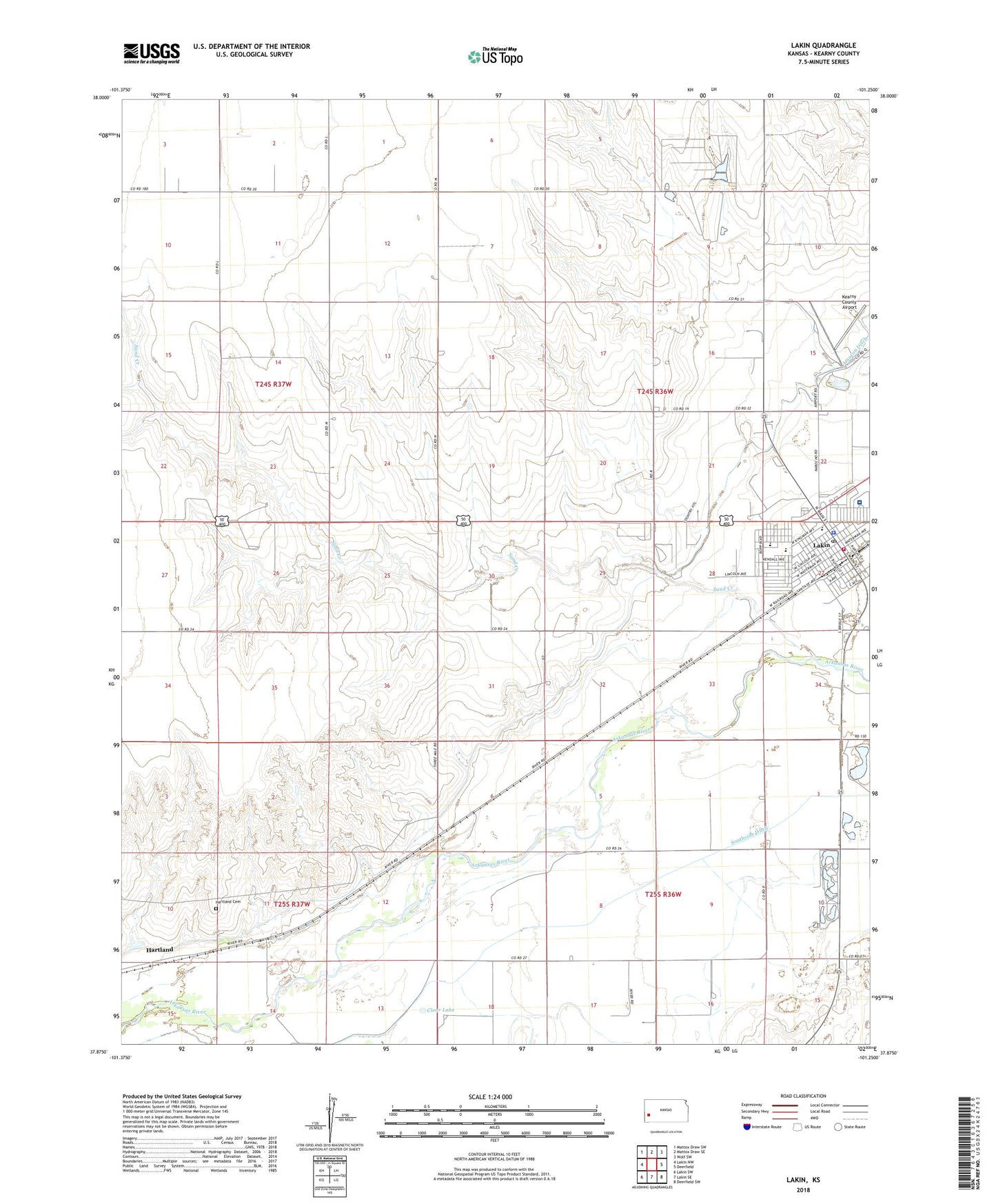
2022 topographic map quadrangle Lakin in the state of Kansas. Scale: 1:24000. Based on the newly updated USGS 7.5' US Topo map series, this map is in the following counties: Kearny. The map contains contour data, water features, and other items you are used to seeing on USGS maps, but also has updated roads and other features. This is the next generation of topographic maps. Printed on high-quality waterproof paper with UV fade-resistant inks.
Quads adjacent to this one:
West: Lakin NW
Northwest: Mattox Draw SW
North: Mattox Draw SE
Northeast: Wolf SW
East: Deerfield
Southeast: Deerfield SW
South: Lakin SE
Southwest: Lakin SW
This map covers the same area as the classic USGS quad with code o37101h3.
Contains the following named places: City of Lakin, Clear Lake, First Baptist Church, First Christian Church, First Presbyterian Church, Hartland, Hartland Cemetery, Immanuel Lutheran Church, Kearny County Airport, Kearny County Courthouse, Kearny County Emergency Medical Services, Kearny County Fairgrounds, Kearny County Fire and Rescue, Kearny County Health Department, Kearny County Historical Museum, Kearny County Hospital, Kearny County Jail, Kearny County Library, Kearny County Sheriff's Office, Lakin, Lakin Administrative Center, Lakin Assembly of God Church, Lakin Church of Christ, Lakin Country Club, Lakin Elementary School, Lakin Grade School, Lakin High School, Lakin Middle School, Lakin Post Office, Lakin Power Plant, Lakin United Methodist Church, Louck Park, Saint Anthony's Catholic Church, Sand Creek, Township of Lakin, Victory Baptist Church, Wesleyan Church