MyTopo
Le Loup Kansas US Topo Map
Couldn't load pickup availability
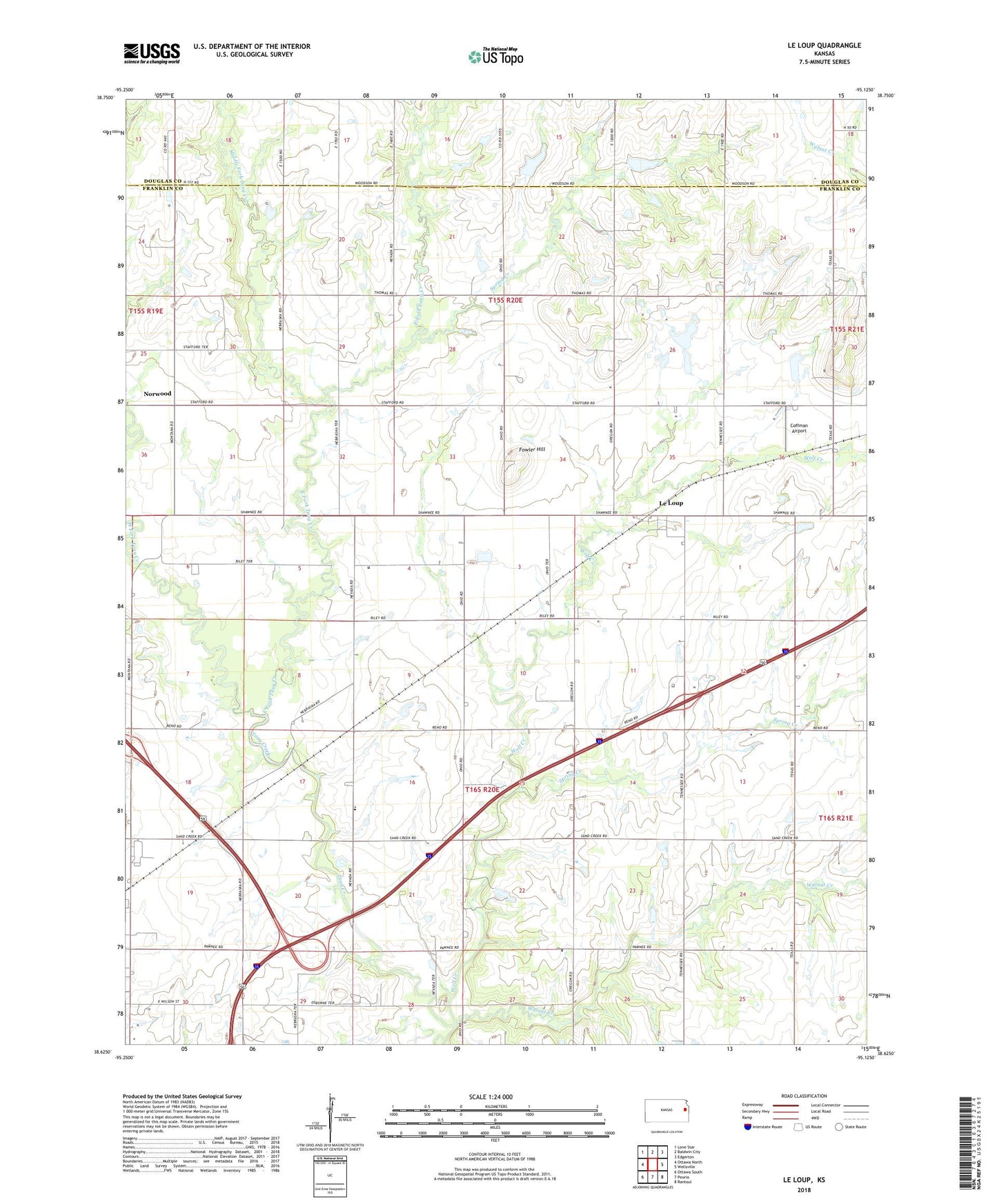
2022 topographic map quadrangle Le Loup in the state of Kansas. Scale: 1:24000. Based on the newly updated USGS 7.5' US Topo map series, this map is in the following counties: Franklin, Douglas. The map contains contour data, water features, and other items you are used to seeing on USGS maps, but also has updated roads and other features. This is the next generation of topographic maps. Printed on high-quality waterproof paper with UV fade-resistant inks.
Quads adjacent to this one:
West: Ottawa North
Northwest: Lone Star
North: Baldwin City
Northeast: Edgerton
East: Wellsville
Southeast: Rantoul
South: Peoria
Southwest: Ottawa South
This map covers the same area as the classic USGS quad with code o38095f2.
Contains the following named places: Bethel Christian Academy, Brown School, Bullard School, Center Chapel, Coffman Airport, East Fork Tauy Creek, Emery Green School, Fowler Hill, Green Dell School, Le Loup, Middle Fork Tauy Creek, New Hope School, Northeast Ottawa Industrial Park, Norwood, Ottawa Indian Mission Burying Ground, Spring Creek, Spring Creek School, Tauy Baptist Church, Tauy Creek, Township of Hayes, Walnut Creek, West Fork Tauy Creek, Wolf Creek