MyTopo
Lenora West Kansas US Topo Map
Couldn't load pickup availability
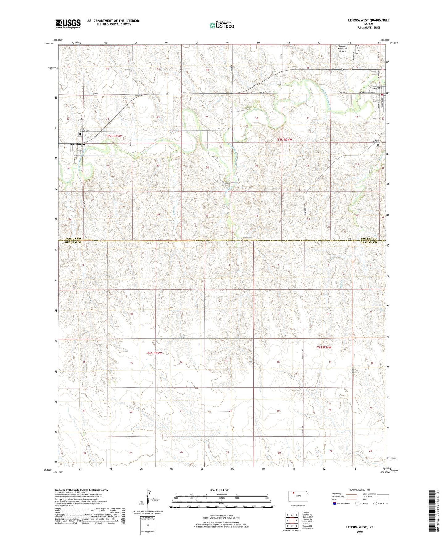
2022 topographic map quadrangle Lenora West in the state of Kansas. Scale: 1:24000. Based on the newly updated USGS 7.5' US Topo map series, this map is in the following counties: Norton, Graham. The map contains contour data, water features, and other items you are used to seeing on USGS maps, but also has updated roads and other features. This is the next generation of topographic maps. Printed on high-quality waterproof paper with UV fade-resistant inks.
Quads adjacent to this one:
West: Clayton SW
Northwest: Clayton
North: Clayton NE
Northeast: Edmond NW
East: Lenora East
Southeast: Hill City NW
South: Morland NE
Southwest: Lucerne
This map covers the same area as the classic USGS quad with code o39100e1.
Contains the following named places: Barbeau House, City of Lenora, Coon Creek, Goshen, Hi-Plains Co - Operative Association Grain Elevator Number 5, Lenora, Lenora Church of God, Lenora City Hall, Lenora Elementary School, Lenora High School, Lenora Post Office, Lenora Public Library, Lenora Senior Center, Lenora South Cemetery, Lenora Volunteer Fire Department, Marsh Creek, New Almelo, Saint Joseph Cemetery, Saint Joseph's Catholic Church, Solomon Valley Rural Fire Department, Township of Allodium, United Parish of Lenora