MyTopo
Marquette Kansas US Topo Map
Couldn't load pickup availability
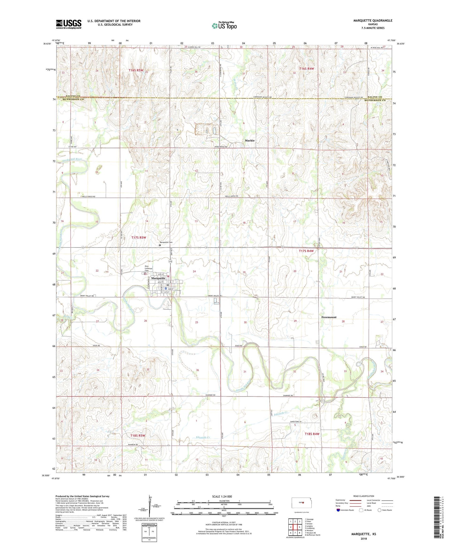
2022 topographic map quadrangle Marquette in the state of Kansas. Scale: 1:24000. Based on the newly updated USGS 7.5' US Topo map series, this map is in the following counties: McPherson, Saline. The map contains contour data, water features, and other items you are used to seeing on USGS maps, but also has updated roads and other features. This is the next generation of topographic maps. Printed on high-quality waterproof paper with UV fade-resistant inks.
Quads adjacent to this one:
West: Langley
Northwest: Venango
North: Falun
Northeast: Smolan
East: Lindsborg
Southeast: McPherson North
South: Windom NE
Southwest: Windom
This map covers the same area as the classic USGS quad with code o38097e7.
Contains the following named places: City of Marquette, Edwards Creek, Elim Lutheran Cemetery, Elim Lutheran Church, Freemont Lutheran Church, Freemount, Kansas Motorcycle Museum, Mackie, Marquette, Marquette Cemetery, Marquette City Hall, Marquette Community Library, Marquette Elementary School, Marquette Emergency Medical Services, Marquette High School, Marquette Historical Museum, Marquette Police Department, Marquette Post Office, Marquette Sewer Treatment Plant, Marquette United Methodist Church, McPherson County Rural Fire District 2 Marquette, Range School Museum, Sharps Creek, Team Marketing Alliance Grain Elevator Number 25, Township of Marquette, Township of Union, Valley Community Church, Wolf Creek