MyTopo
Montezuma Kansas US Topo Map
Couldn't load pickup availability
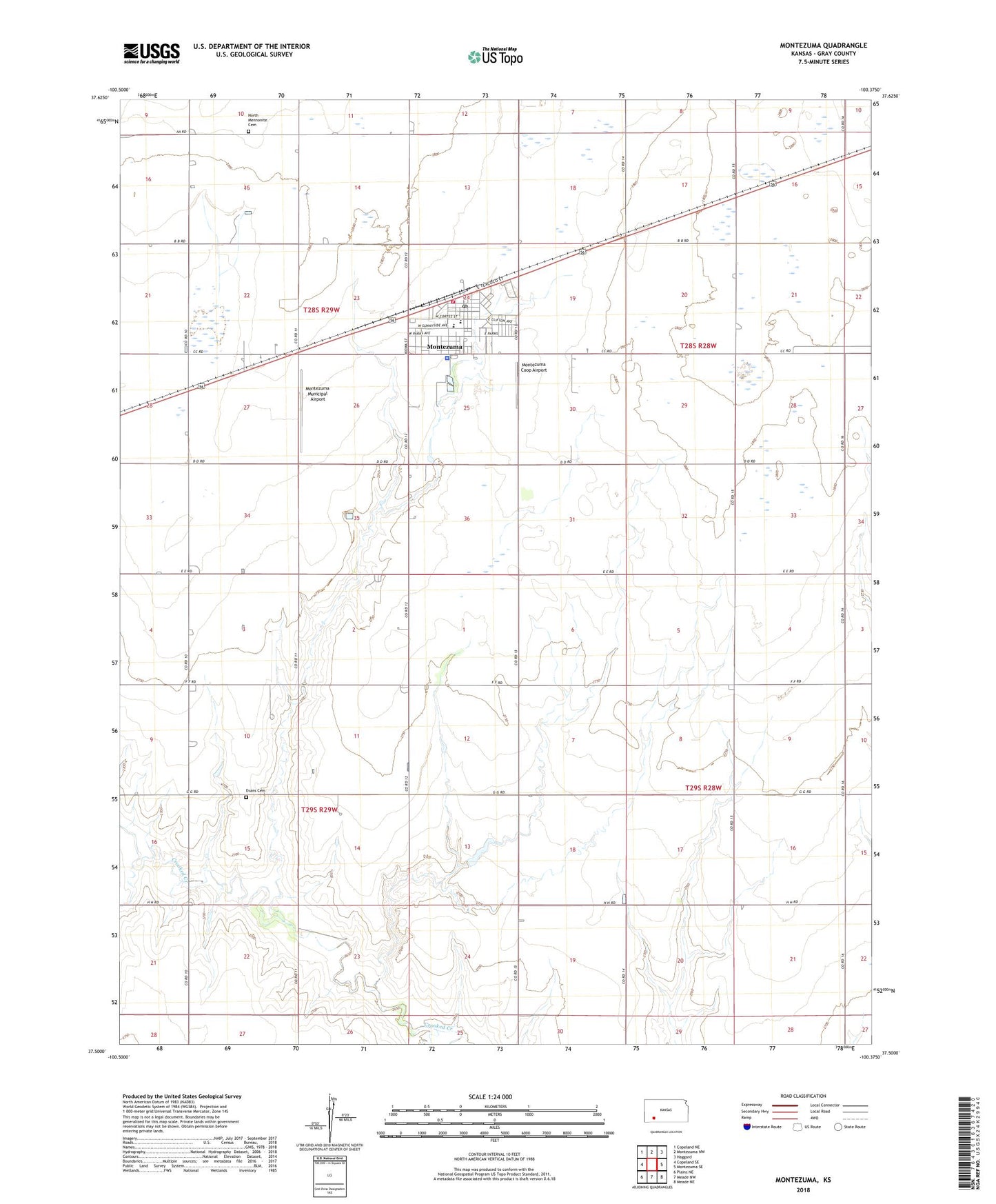
2022 topographic map quadrangle Montezuma in the state of Kansas. Scale: 1:24000. Based on the newly updated USGS 7.5' US Topo map series, this map is in the following counties: Gray. The map contains contour data, water features, and other items you are used to seeing on USGS maps, but also has updated roads and other features. This is the next generation of topographic maps. Printed on high-quality waterproof paper with UV fade-resistant inks.
Quads adjacent to this one:
West: Copeland SE
Northwest: Copeland NE
North: Montezuma NW
Northeast: Haggard
East: Montezuma SE
Southeast: Meade NE
South: Meade NW
Southwest: Plains NE
This map covers the same area as the classic USGS quad with code o37100e4.
Contains the following named places: City of Montezuma, Crooked Creek Country Club, Dodge City Co - Operative Exchange Grain Elevator Number 14, Evans Cemetery, Gospel Fellowship Church, Gray County Emergency Medical Services Montezuma Station, Hess, Homeland Mennonite Church, Montezuma, Montezuma Church of God in Christ, Montezuma City Hall, Montezuma City Police, Montezuma Coop Airport, Montezuma Elementary School, Montezuma Municipal Airport, Montezuma Post Office, Montezuma Public Works, Montezuma Senior Center and Community Hall, Montezuma Township Library, Montezuma United Methodist Church, Montezuma Volunteer Fire Department, Montezuma Wastewater Plant, Morningside Community Church, North Mennonite Cemetery, South Gray High School, Stauth Memorial Museum, Township of Montezuma, ZIP Code: 67867