MyTopo
Moscow Kansas US Topo Map
Couldn't load pickup availability
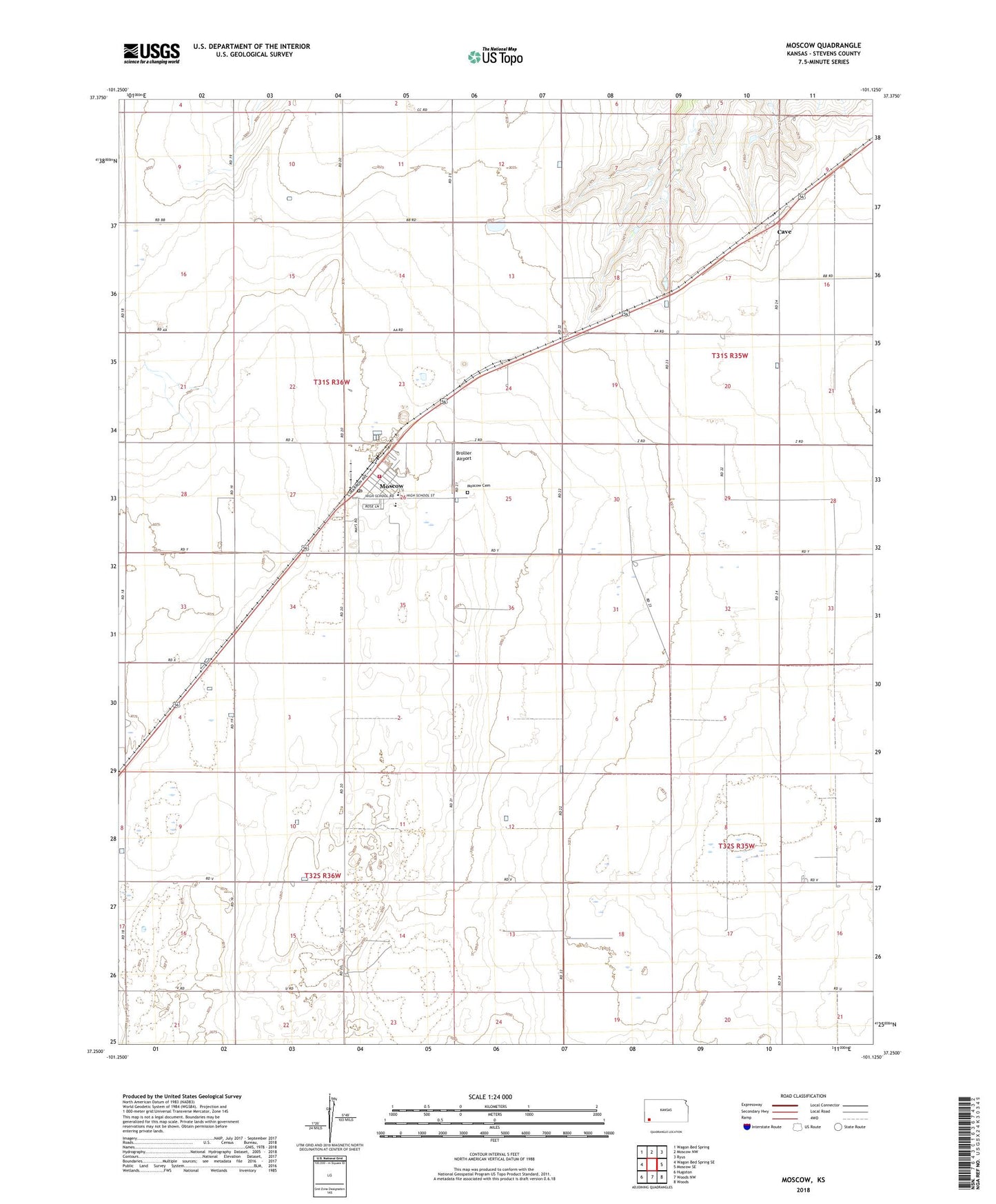
2022 topographic map quadrangle Moscow in the state of Kansas. Scale: 1:24000. Based on the newly updated USGS 7.5' US Topo map series, this map is in the following counties: Stevens. The map contains contour data, water features, and other items you are used to seeing on USGS maps, but also has updated roads and other features. This is the next generation of topographic maps. Printed on high-quality waterproof paper with UV fade-resistant inks.
Quads adjacent to this one:
West: Wagon Bed Spring SE
Northwest: Wagon Bed Spring
North: Moscow NW
Northeast: Ryus
East: Moscow SE
Southeast: Woods
South: Woods NW
Southwest: Hugoton
This map covers the same area as the classic USGS quad with code o37101c2.
Contains the following named places: Cave, City of Moscow, G&AG Airport, Moscow, Moscow Baptist Church, Moscow Cemetery, Moscow City Hall, Moscow Elementary School, Moscow Junior / Senior High School, Moscow Post Office, Moscow Senior Center, Moscow United Methodist Church, Moscow Wastewater Treatment Facility, Pearl City, Ramsey School, Stevens County Fire Department Moscow Station, Township of Moscow, Valaparaiso, Vanceville School, Zella, ZIP Code: 67952