MyTopo
Mullinville Kansas US Topo Map
Couldn't load pickup availability
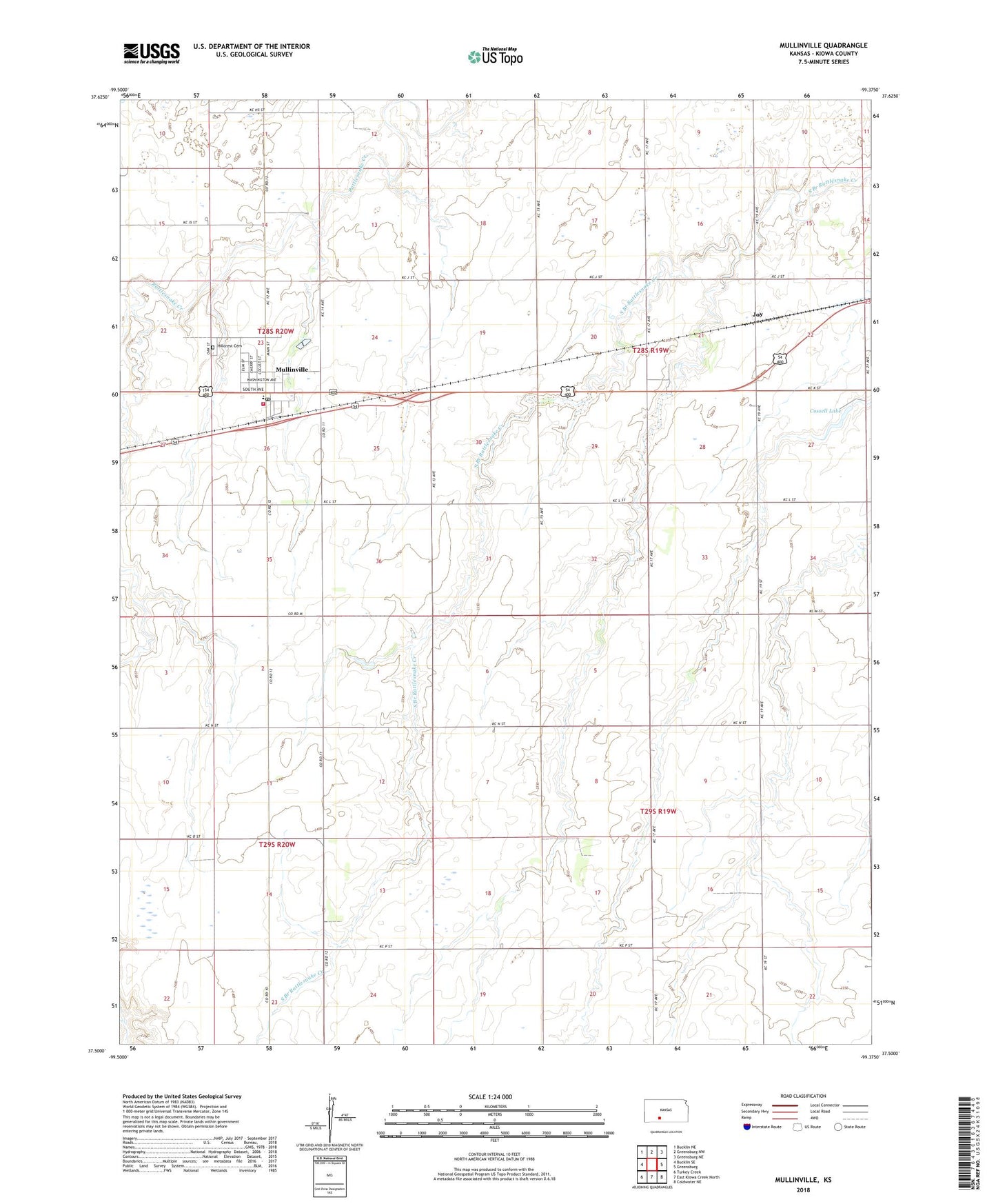
2022 topographic map quadrangle Mullinville in the state of Kansas. Scale: 1:24000. Based on the newly updated USGS 7.5' US Topo map series, this map is in the following counties: Kiowa. The map contains contour data, water features, and other items you are used to seeing on USGS maps, but also has updated roads and other features. This is the next generation of topographic maps. Printed on high-quality waterproof paper with UV fade-resistant inks.
Quads adjacent to this one:
West: Bucklin SE
Northwest: Bucklin NE
North: Greensburg NW
Northeast: Greensburg NE
East: Greensburg
Southeast: Coldwater NE
South: East Kiowa Creek North
Southwest: Turkey Creek
This map covers the same area as the classic USGS quad with code o37099e4.
Contains the following named places: 21st Century Learning Academy, 67109, City of Mullinville, Cossell Lake, Cossell Lake Dam, Hillcrest Cemetery, Joy, Mullinville, Mullinville Elementary School, Mullinville Fire Department, Mullinville Junior High School, Mullinville Post Office, Mullinville United Methodist Church, Mullinville Wastewater Plant, Right Co - Operative Association Grain Elevator Number 5, Southern Plains Co - Operative at Lewis Kansas Grain Elevator Number 6, Thach Gas Field, Unorganized Territory of West Kiowa, Washington Park