MyTopo
Norcatur Kansas US Topo Map
Couldn't load pickup availability
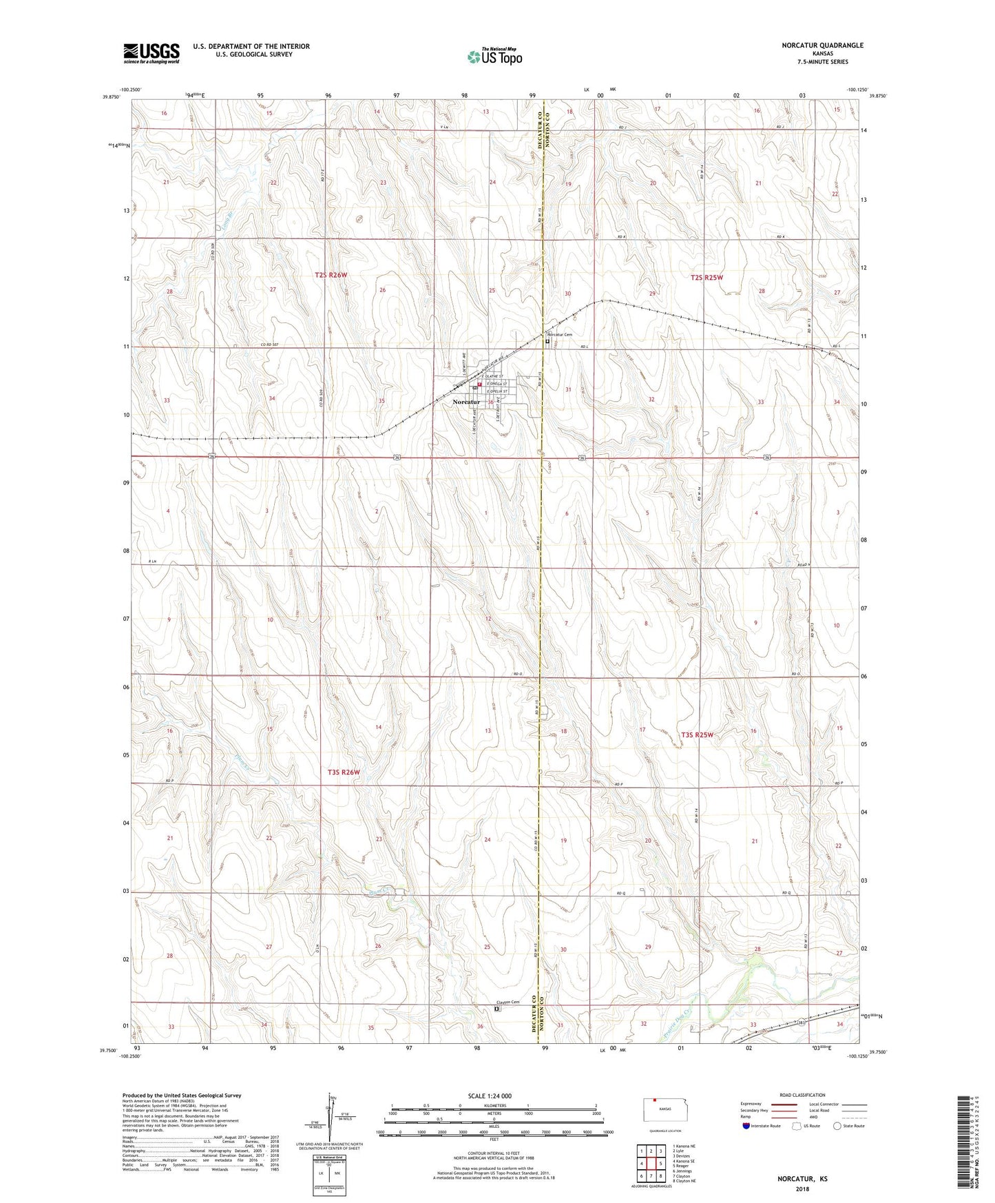
2022 topographic map quadrangle Norcatur in the state of Kansas. Scale: 1:24000. Based on the newly updated USGS 7.5' US Topo map series, this map is in the following counties: Decatur, Norton. The map contains contour data, water features, and other items you are used to seeing on USGS maps, but also has updated roads and other features. This is the next generation of topographic maps. Printed on high-quality waterproof paper with UV fade-resistant inks.
Quads adjacent to this one:
West: Kanona SE
Northwest: Kanona NE
North: Lyle
Northeast: Devizes
East: Reager
Southeast: Clayton NE
South: Clayton
Southwest: Jennings
This map covers the same area as the classic USGS quad with code o39100g2.
Contains the following named places: City of Norcatur, Clayton Cemetery, Norcatur, Norcatur Cemetery, Norcatur Elementary School, Norcatur Post Office, Norcatur United Methodist Church, Norcatur Volunteer Fire Department, Norcatur Wastewater Treatment Facility, Pleasant Hill School, Prairie Belle School, Stapp Ranch, Township of Garfield, Township of Lincoln