MyTopo
Pierceville Kansas US Topo Map
Couldn't load pickup availability
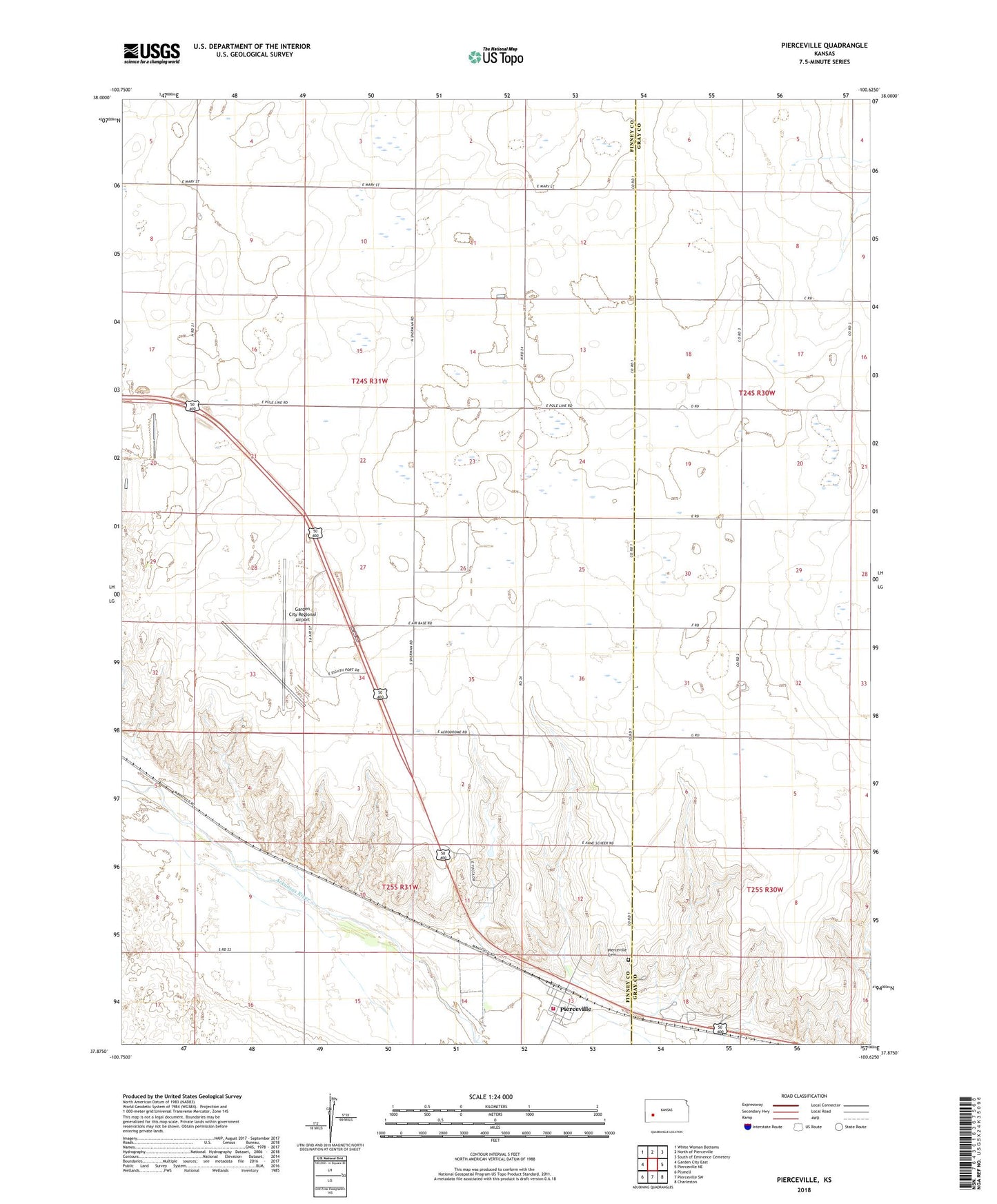
2022 topographic map quadrangle Pierceville in the state of Kansas. Scale: 1:24000. Based on the newly updated USGS 7.5' US Topo map series, this map is in the following counties: Finney, Gray. The map contains contour data, water features, and other items you are used to seeing on USGS maps, but also has updated roads and other features. This is the next generation of topographic maps. Printed on high-quality waterproof paper with UV fade-resistant inks.
Quads adjacent to this one:
West: Garden City East
Northwest: White Woman Bottoms
North: North of Pierceville
Northeast: South of Eminence Cemetery
East: Pierceville NE
Southeast: Charleston
South: Pierceville SW
Southwest: Plymell
This map covers the same area as the classic USGS quad with code o37100h6.
Contains the following named places: EagleMed Air Ambulance, Garden City Army Air Field, Garden City Municipal Airport Wastewater Treatment Plant, Garden City Regional Airport, Garden City Regional Airport Industrial Park, Pierceville, Pierceville Cemetery, Pierceville Census Designated Place, Pierceville Federated Church, Pierceville Township Fire Department, The Airport Raceway, Township of Pierceville