MyTopo
Plains Kansas US Topo Map
Couldn't load pickup availability
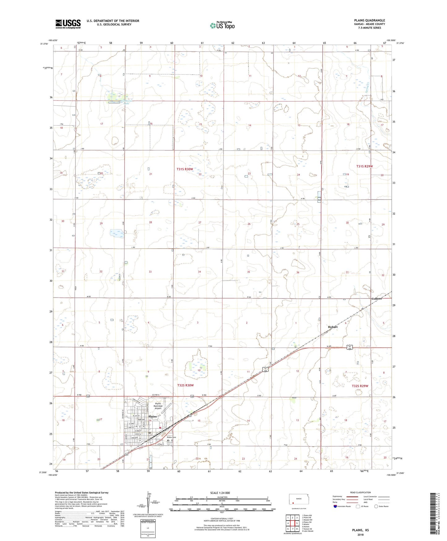
2022 topographic map quadrangle Plains in the state of Kansas. Scale: 1:24000. Based on the newly updated USGS 7.5' US Topo map series, this map is in the following counties: Meade. The map contains contour data, water features, and other items you are used to seeing on USGS maps, but also has updated roads and other features. This is the next generation of topographic maps. Printed on high-quality waterproof paper with UV fade-resistant inks.
Quads adjacent to this one:
West: Plains SW
Northwest: Plains NW
North: Plains NE
Northeast: Meade NW
East: Missler
Southeast: Lake Meade
South: Kismet NE
Southwest: Kismet
This map covers the same area as the classic USGS quad with code o37100c5.
Contains the following named places: City of Plains, Collano, First Baptist Church, Friends Church of Plains, Hobart, Plains, Plains Cemetery, Plains Christian Chruch, Plains City Fire Department, Plains City Hall, Plains Community Library, Plains Elementary School, Plains Golf Course, Plains Municipal Airport, Plains Post Office, Plains Public Works, Plains Rural Fire Department, Plains United Methodist Church, Plains Wastewater Plant, Saint Patrick Catholic Church, Wildhorse Lake