MyTopo
Saint Francis NW Kansas US Topo Map
Couldn't load pickup availability
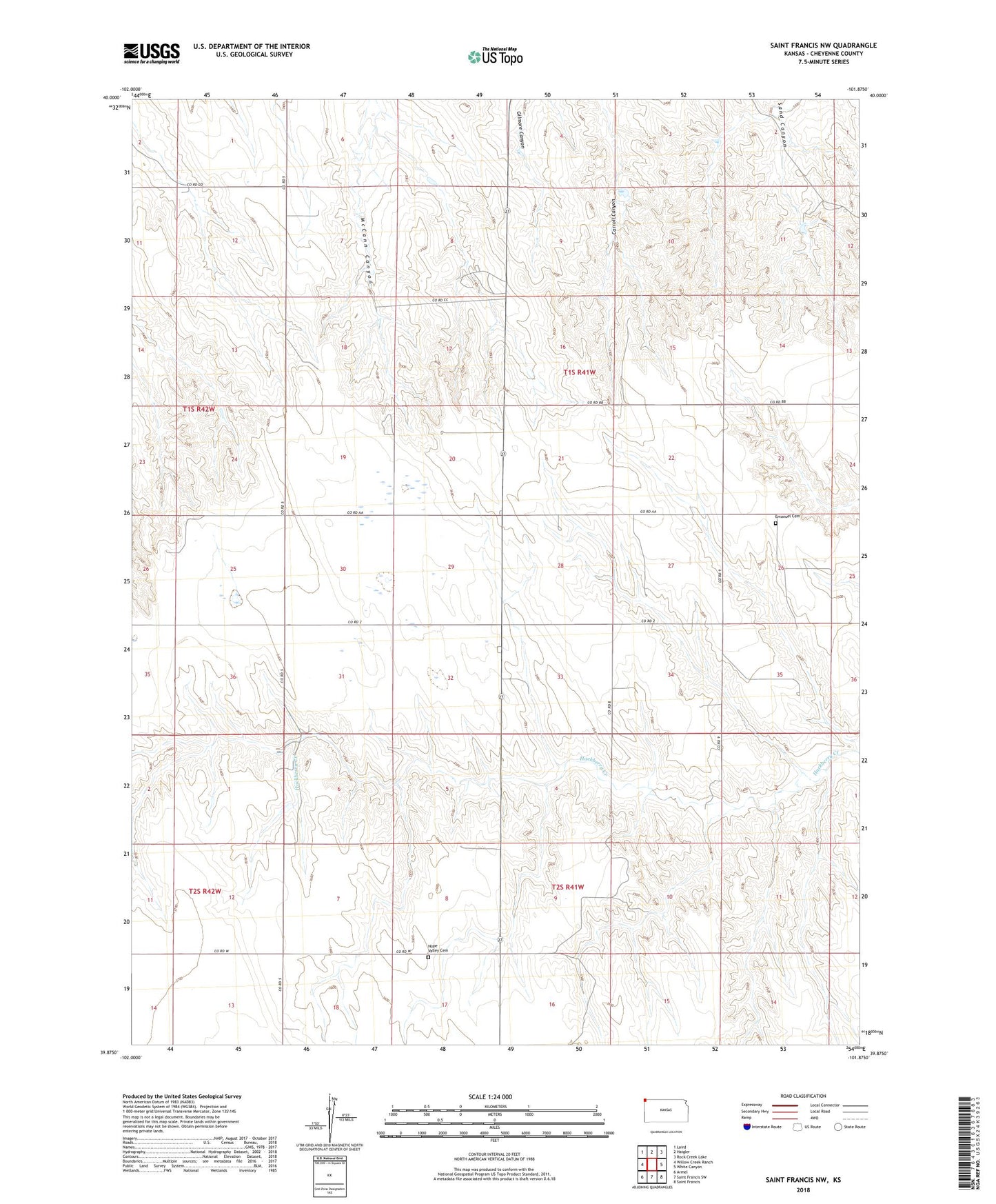
2022 topographic map quadrangle Saint Francis NW in the state of Kansas. Scale: 1:24000. Based on the newly updated USGS 7.5' US Topo map series, this map is in the following counties: Cheyenne. The map contains contour data, water features, and other items you are used to seeing on USGS maps, but also has updated roads and other features. This is the next generation of topographic maps. Printed on high-quality waterproof paper with UV fade-resistant inks.
Quads adjacent to this one:
West: Willow Creek Ranch
Northwest: Laird
North: Haigler
Northeast: Rock Creek Lake
East: White Canyon
Southeast: Saint Francis
South: Saint Francis SW
Southwest: Armel
This map covers the same area as the classic USGS quad with code o39101h8.
Contains the following named places: Emanuel Church, German Plains School, Green Valley School, Hope Valley Cemetery, Immanuel Lutheran Cemetery, Pleasant Hill School, Scrivner Ranch