MyTopo
Selden Kansas US Topo Map
Couldn't load pickup availability
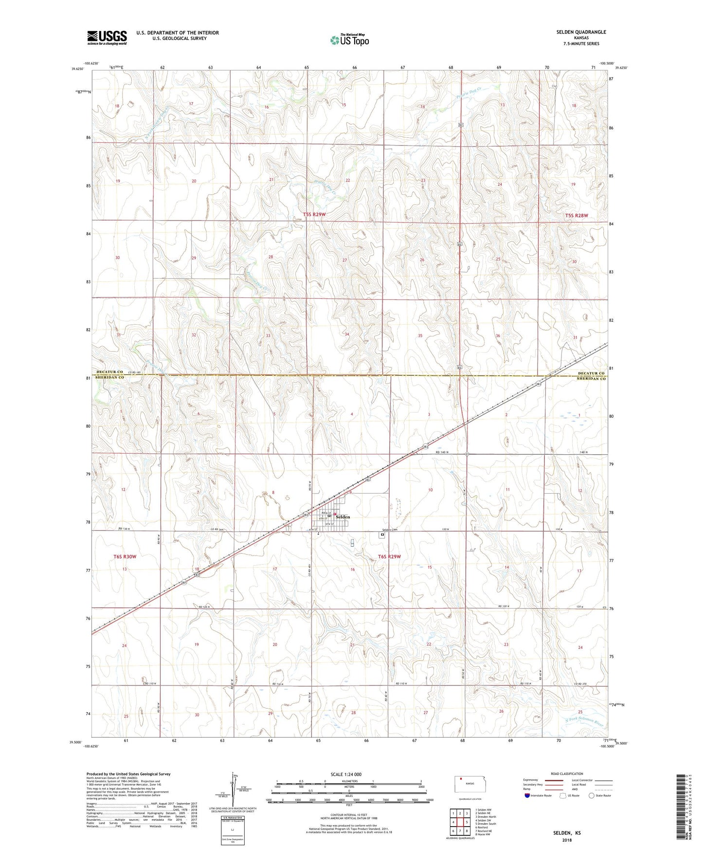
2022 topographic map quadrangle Selden in the state of Kansas. Scale: 1:24000. Based on the newly updated USGS 7.5' US Topo map series, this map is in the following counties: Sheridan, Decatur. The map contains contour data, water features, and other items you are used to seeing on USGS maps, but also has updated roads and other features. This is the next generation of topographic maps. Printed on high-quality waterproof paper with UV fade-resistant inks.
Quads adjacent to this one:
West: Selden SW
Northwest: Selden NW
North: Selden NE
Northeast: Dresden North
East: Dresden South
Southeast: Hoxie NW
South: Rexford NE
Southwest: Rexford
This map covers the same area as the classic USGS quad with code o39100e5.
Contains the following named places: City of Selden, Golden Plains Elementary School, Hi-Plains Co - Operative Association Grain Elevator Number 6, Sacred Heart Catholic Church, Selden, Selden Cemetery, Selden Post Office, Selden Public Library, Selden United Methodist Church, Selden Wastewater Plant, Sheridan County Rural Fire Station, Township of Prairie Dog, Township of Sheridan, ZIP Code: 67757