MyTopo
Studley Kansas US Topo Map
Couldn't load pickup availability
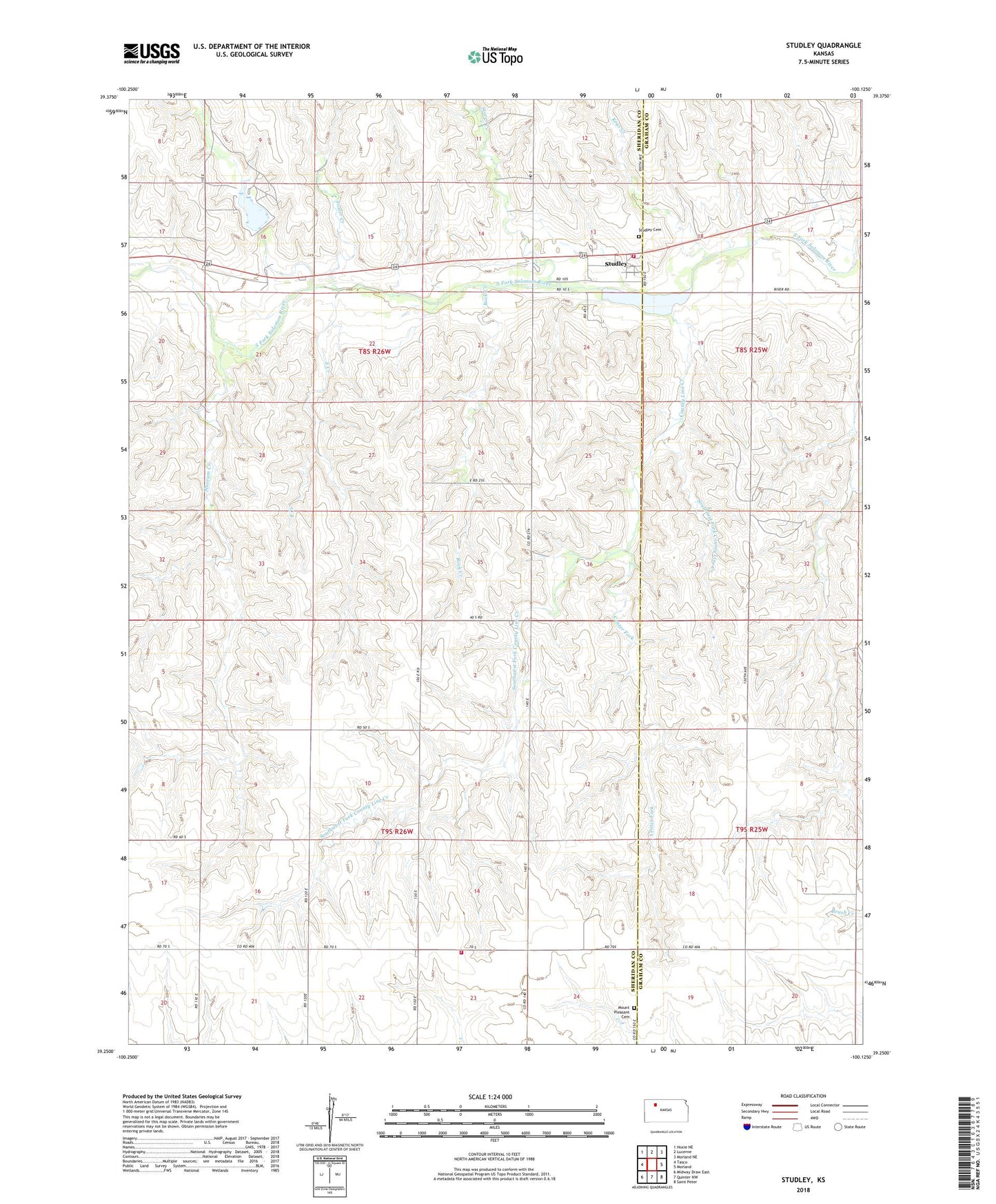
2022 topographic map quadrangle Studley in the state of Kansas. Scale: 1:24000. Based on the newly updated USGS 7.5' US Topo map series, this map is in the following counties: Sheridan, Graham. The map contains contour data, water features, and other items you are used to seeing on USGS maps, but also has updated roads and other features. This is the next generation of topographic maps. Printed on high-quality waterproof paper with UV fade-resistant inks.
Quads adjacent to this one:
West: Tasco
Northwest: Hoxie NE
North: Lucerne
Northeast: Morland NE
East: Morland
Southeast: Saint Peter
South: Quinter NW
Southwest: Midway Draw East
This map covers the same area as the classic USGS quad with code o39100c2.
Contains the following named places: Center Fork, Cottonwood Ranch, County Line Creek, East Creek, Foster Creek, Frontier Agricultural Grain Elevator Number 23, Keys Creek, Mount Pleasant Baptist Church, Mount Pleasant Cemetery, Museum, Museum Creek, North Creek, Rock Creek, Sheridan County Rural Fire District 1 Redline Station, Sheridan County Rural Fire District 1 Studley Station, Sheridan County State Lake, Sheridan County State Lake Dam, Sheridan State Fishing Lake, Southeast Fork County Line Creek, Southwest Fork County Line Creek, Storer Creek, Studley, Studley Cemetery