MyTopo
Syracuse West Kansas US Topo Map
Couldn't load pickup availability
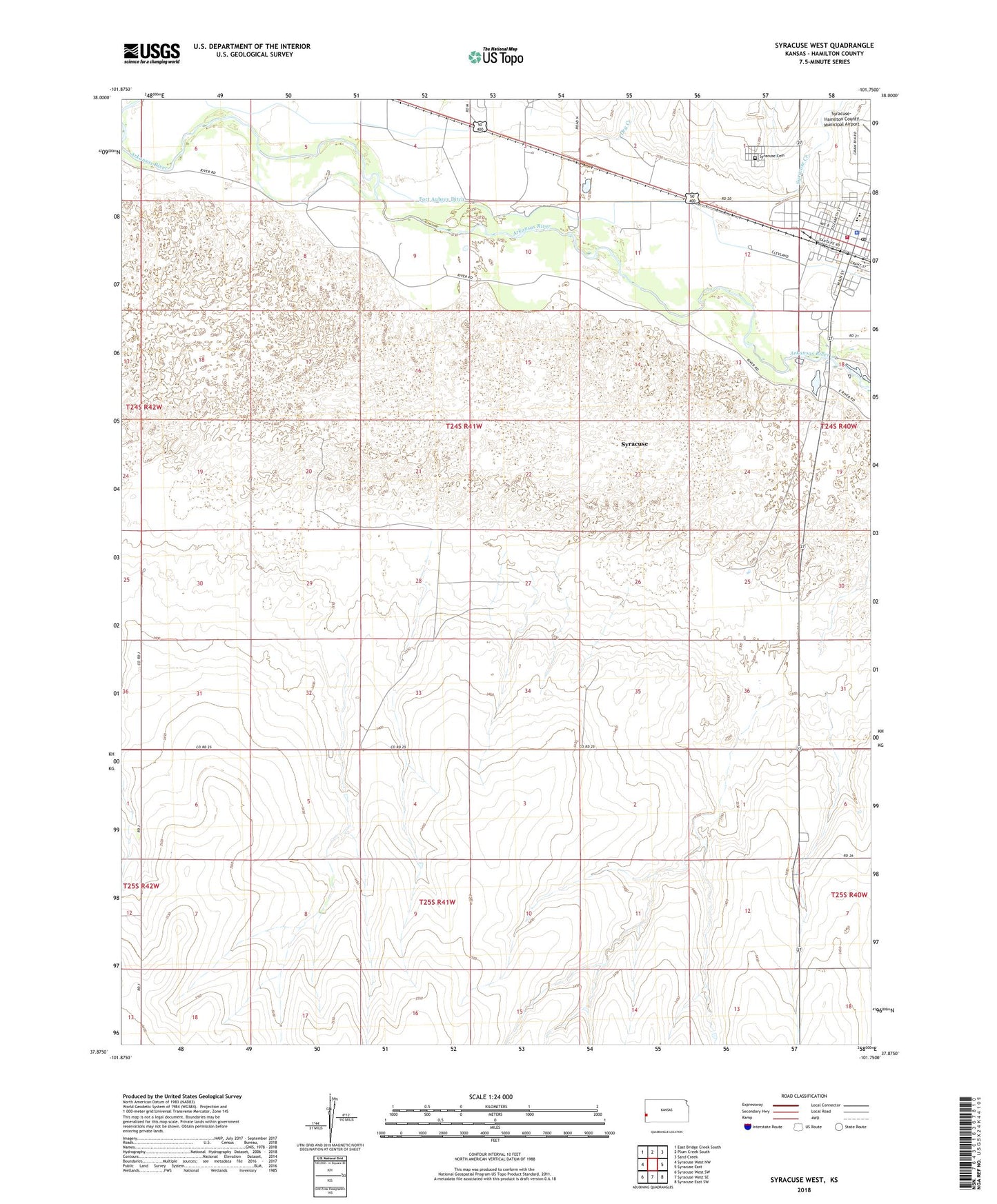
2022 topographic map quadrangle Syracuse West in the state of Kansas. Scale: 1:24000. Based on the newly updated USGS 7.5' US Topo map series, this map is in the following counties: Hamilton. The map contains contour data, water features, and other items you are used to seeing on USGS maps, but also has updated roads and other features. This is the next generation of topographic maps. Printed on high-quality waterproof paper with UV fade-resistant inks.
Quads adjacent to this one:
West: Syracuse West NW
Northwest: East Bridge Creek South
North: Plum Creek South
Northeast: Sand Creek
East: Syracuse East
Southeast: Syracuse East SW
South: Syracuse West SE
Southwest: Syracuse West SW
This map covers the same area as the classic USGS quad with code o37101h7.
Contains the following named places: Bible Baptist Church, City of Syracuse, First Christian Church, First United Methodist Church, Hamilton County, Hamilton County Courthouse, Hamilton County Department of Public Works, Hamilton County Fairgrounds, Hamilton County Fire Department Station 1, Hamilton County Jail, Hamilton County Landfill, Hamilton County Library, Hamilton County Museum, Hamilton County Sheriff's Office, Northrup Theatre, Southern Baptist Church, Syracuse, Syracuse Cemetery, Syracuse City Hall, Syracuse Creek, Syracuse Elementary School, Syracuse Fire Department, Syracuse High School, Syracuse Post Office