MyTopo
Wayne Kansas US Topo Map
Couldn't load pickup availability
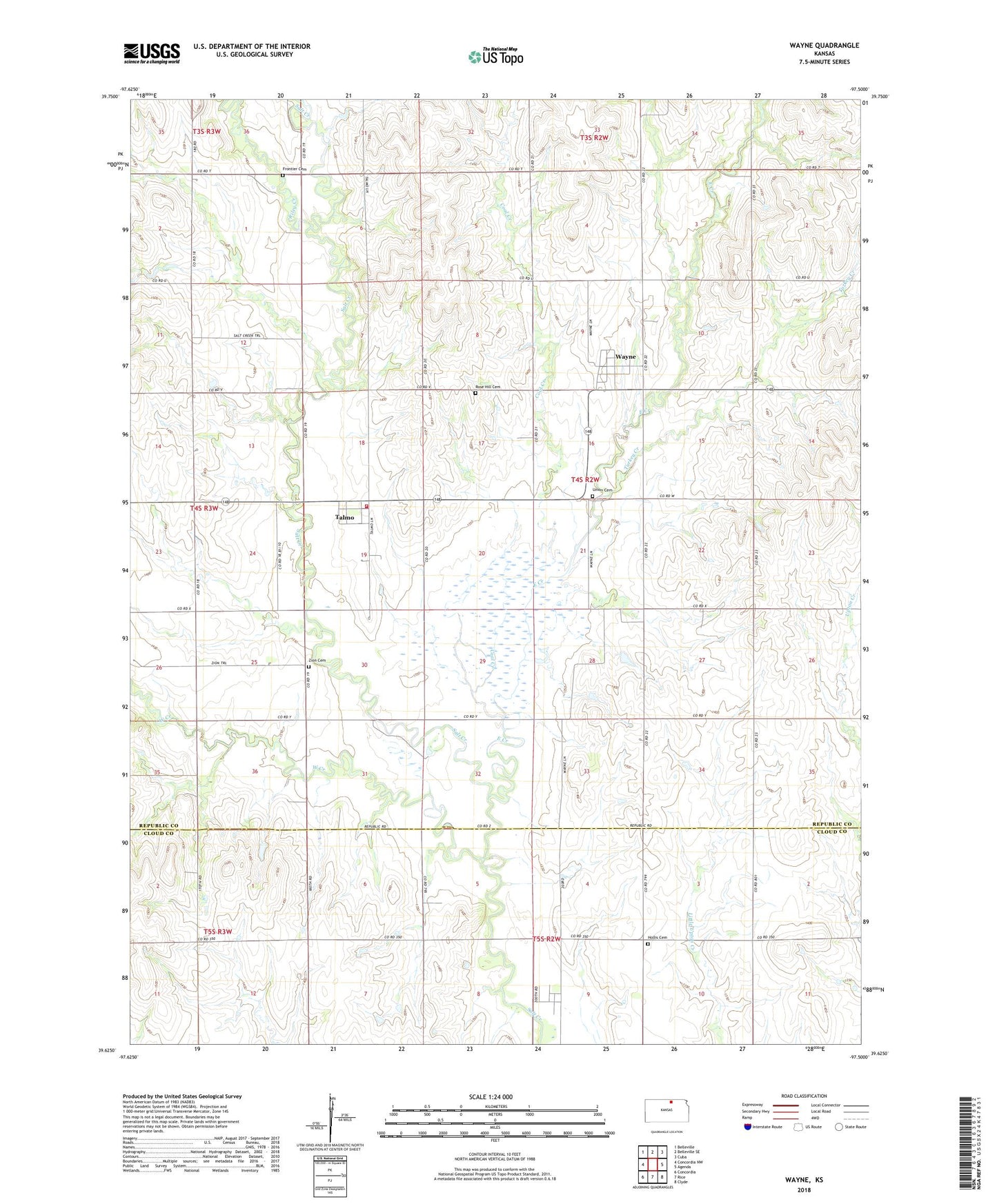
2022 topographic map quadrangle Wayne in the state of Kansas. Scale: 1:24000. Based on the newly updated USGS 7.5' US Topo map series, this map is in the following counties: Republic, Cloud. The map contains contour data, water features, and other items you are used to seeing on USGS maps, but also has updated roads and other features. This is the next generation of topographic maps. Printed on high-quality waterproof paper with UV fade-resistant inks.
Quads adjacent to this one:
West: Concordia NW
Northwest: Belleville
North: Belleville SE
Northeast: Cuba
East: Agenda
Southeast: Clyde
South: Rice
Southwest: Concordia
This map covers the same area as the classic USGS quad with code o39097f5.
Contains the following named places: Coal Creek, East Creek, Frontier Cemetery, Hollis, Hollis Cemetery, Hollis School, Minersville, Riley Creek, Rose Hill Cemetery, Seapo, Talmo, Talmo - Wayne Fire District 6, Township of Grant, Turkey Creek, Union Cemetery, Wayne, West Creek, Zion Cemetery