MyTopo
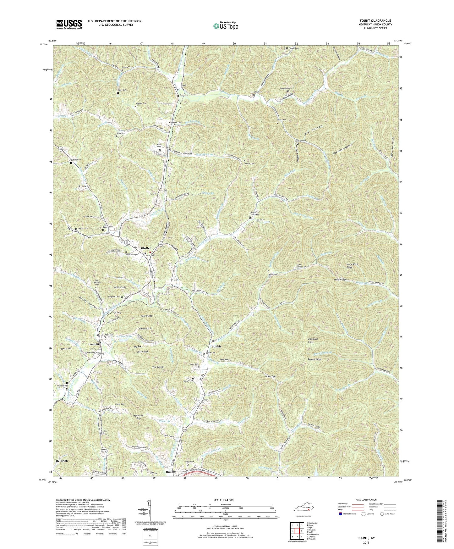
Fount Kentucky US Topo Map
Couldn't load pickup availability
2022 topographic map quadrangle Fount in the state of Kentucky. Scale: 1:24000. Based on the newly updated USGS 7.5' US Topo map series, this map is in the following counties: Knox. The map contains contour data, water features, and other items you are used to seeing on USGS maps, but also has updated roads and other features. This is the next generation of topographic maps. Printed on high-quality waterproof paper with UV fade-resistant inks.
Quads adjacent to this one:
West: Heidrick
Northwest: Blackwater
North: Hima
Northeast: Ogle
East: Scalf
Southeast: Pineville
South: Artemus
Southwest: Barbourville
This map covers the same area as the classic USGS quad with code o36083h7.
Contains the following named places: Abel Post Office, Asher Branch, Asher Cemetery, Bailey Branch, Barley Hollow, Beech Hill, Beech Spring Church, Beech Springs Church, Beech Springs School, Big Hollow, Big Rock, Bimble, Bingham Cemetery, Black Cemetery, Black Lick Branch, Bull Creek, Bunker Branch, Burton Branch, Callebs Creek, Callebs Creek Cemetery, Callebs Creek School, Cannon, Cannon Lake, Cannon Post Office, Cannon Railroad Station, Carnes Branch, Carty Cemetery, Castle Cemetery, Chestnut Flats, Clark-Hinkle Cemetery, Clinch Knob, Cobb Cemetery, Cole Ridge, Dancey Branch, Deep Cut, Dozier Branch, Dozier School, Dripping Spring Church, Fisher Cemetery, Fount, Fount Elementary School, Fount Junior High School, Fount Post Office, Fount Railroad Station, Friendship Church, Frisby Branch, Gambrel Cemetery, Garden Hollow, George Hale Branch, Gibson Cemetery, Gilbert Cemetery, Girdler, Girdler Division, Girdler Post Office, Green Branch, Green Road, Green Road Church, Green Road Railroad Station, Green Road School, Greenbriar Branch, Gregory Cemetery, Grove Church, Grove School, Hale Branch, Hammans Branch, Hammons Cemetery, Hammons Fork, Hammons Gap, Hampton Cemetery, Hardy Branch, Hawn Branch, Hawn Cemetery, Hawn Gap, Hignite Cemetery, Hinkle, Hinkle Gap, Hinkle Post Office, Hog Wallow Hollow, Horn Branch, Horn Branch Church, Horn Branch School, Horse Pens Ridge, Hughes Branch, Jarvis Branch, John Hale Branch, Jones Cemetery, Jones Fork, Jordan Branch, Knox County, Lawrence Branch, Little Bull Creek, Little Rock, Locust Grove Church, Locust Grove School, Long Branch, Lost Fork, Lower Cumberland, Mac Williams Cemetery, Marion Cemetery, Martin Hollow, Mattingly Branch, Messer Cemetery, Miller Branch, Mills Cemetery, Mount Carmel School, Mulberry Fork, Nealie Branch, Numan Branch, Old House Hollow, Orchard Hollow, Parrot Branch, Patterson Branch, Payne Creek, Paynes Branch, Pennsy Store, Phillip Branch, Pittman Cemetery, Powell Branch, Powell Hale Branch, Powell Ridge, Pumpkin Run Branch, Richland Fire Department, Ridner Branch, Riley Cemetery, Riley Fork, Rock Spring Church, Rock Spring School, Shop Branch, Sinking Valley Baptist Church, Sinking Valley School, Slick Lizard Coal Camp, Smith Branch, Spruce Pine Branch, Stacey Cemetery, Sublimity Hollow, Sugar Camp Branch, The Corral, Tom Doolin Fork, Trace Branch, Trace Branch Post Office, Trace Branch School, Trace Branch United Methodist Church, Tulley Branch, Valentine Branch, Warren Cemetery, Williams Branch, Williamson Branch, Williamson Cemetery, Willis Knob, Wyrick Branch, Yaeger Cemetery, ZIP Codes: 40915, 40923, 40943, 40946, 40949, 40953


