MyTopo
Wesleyville Kentucky US Topo Map
Couldn't load pickup availability
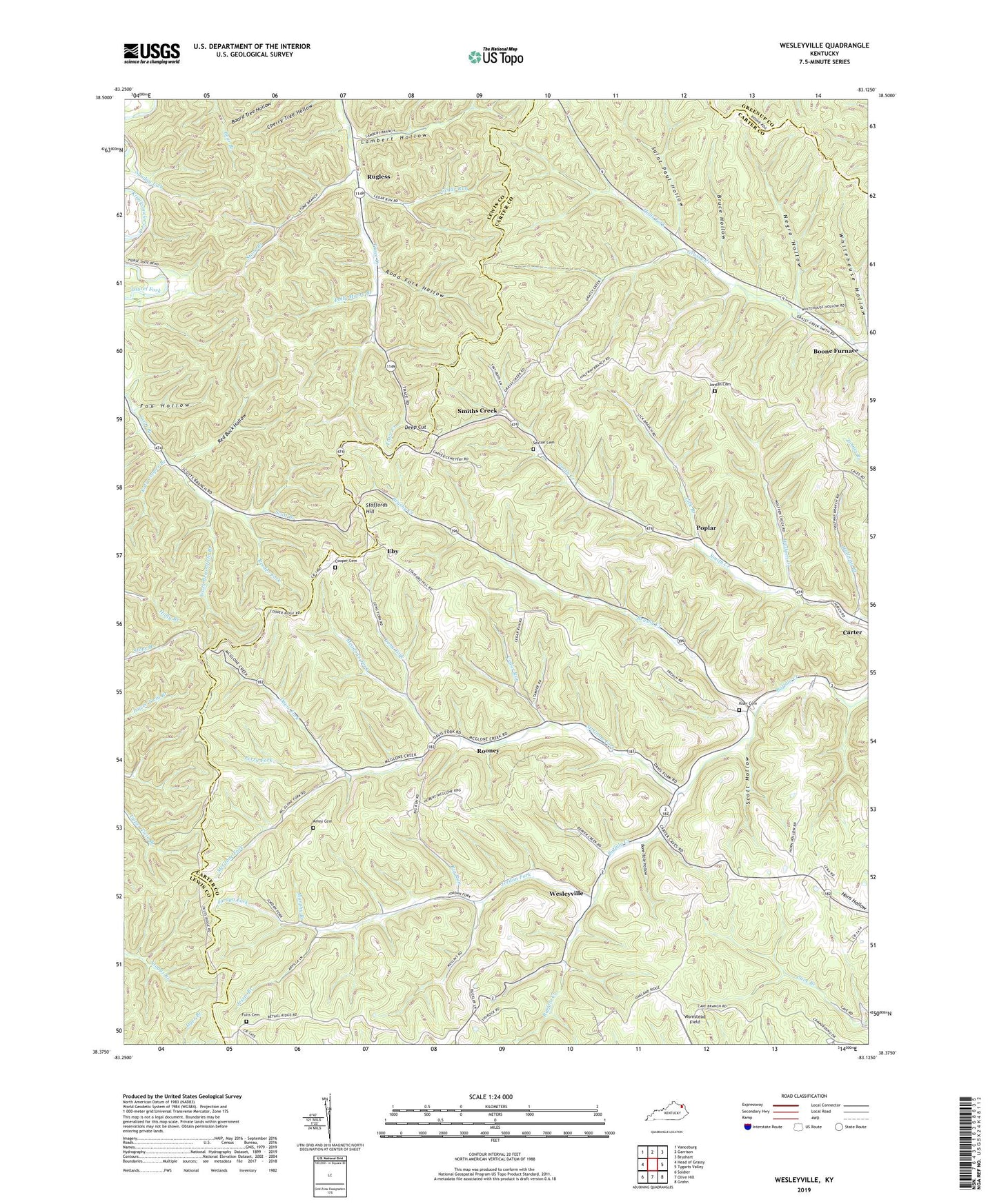
2022 topographic map quadrangle Wesleyville in the state of Kentucky. Scale: 1:24000. Based on the newly updated USGS 7.5' US Topo map series, this map is in the following counties: Carter, Lewis, Greenup. The map contains contour data, water features, and other items you are used to seeing on USGS maps, but also has updated roads and other features. This is the next generation of topographic maps. Printed on high-quality waterproof paper with UV fade-resistant inks.
Quads adjacent to this one:
West: Head of Grassy
Northwest: Vanceburg
North: Garrison
Northeast: Brushart
East: Tygarts Valley
Southeast: Grahn
South: Olive Hill
Southwest: Soldier
This map covers the same area as the classic USGS quad with code o38083d2.
Contains the following named places: Amy McGlone Cemetery, Bethel Church, Big Run, Bone Hole Hollow, Boone Church, Boone Furnace, Boone Furnace School, Bruce Hollow, Brushy Creek, Brushy School, Carter Division, Cedar Run, Cooper Cemetery, Davis Fork, Deep Cut, Eby, Fox Hollow, Fults Cemetery, Halfway Branch, Halls Fork, Jessie Branch, Jordan Cemetery, Jordan Fork, Jordan Fork School, Katy Cooper Branch, Kibbey Church, Kiser Cemetery, Lambert Hollow, Lick Branch, Long Fork, McGlone Fork, McGlone Fork School, Meadows Fork, Mount Pleasant Church, Murphy Branch, Negro Hollow, Oakland Church, Oakland School, Perry Fork, Polly Moore Branch, Poplar, Red Buck Hollow, Reeder Fork, Road Fork Hollow, Road Post Office, Rooney, Rugless, Rugless Post Office, Saint Paul Hollow, Scott Branch Church, Scott Branch School, Scott Hollow, Sexton Cemetery, Smith Creek Church, Smith Creek School, Smiths Creek, Smiths Creek Post Office, Stafford Hill School, Staffords Hill, Stone Branch, Stone Branch Railroad Station, Tygarts State Forest, Upper Grassy School, Wash Broomfield Branch, Wesleyville, Wesleyville Church, Wesleyville School, Wolfpen Creek, Womstead Field