MyTopo
Clay Louisiana US Topo Map
Couldn't load pickup availability
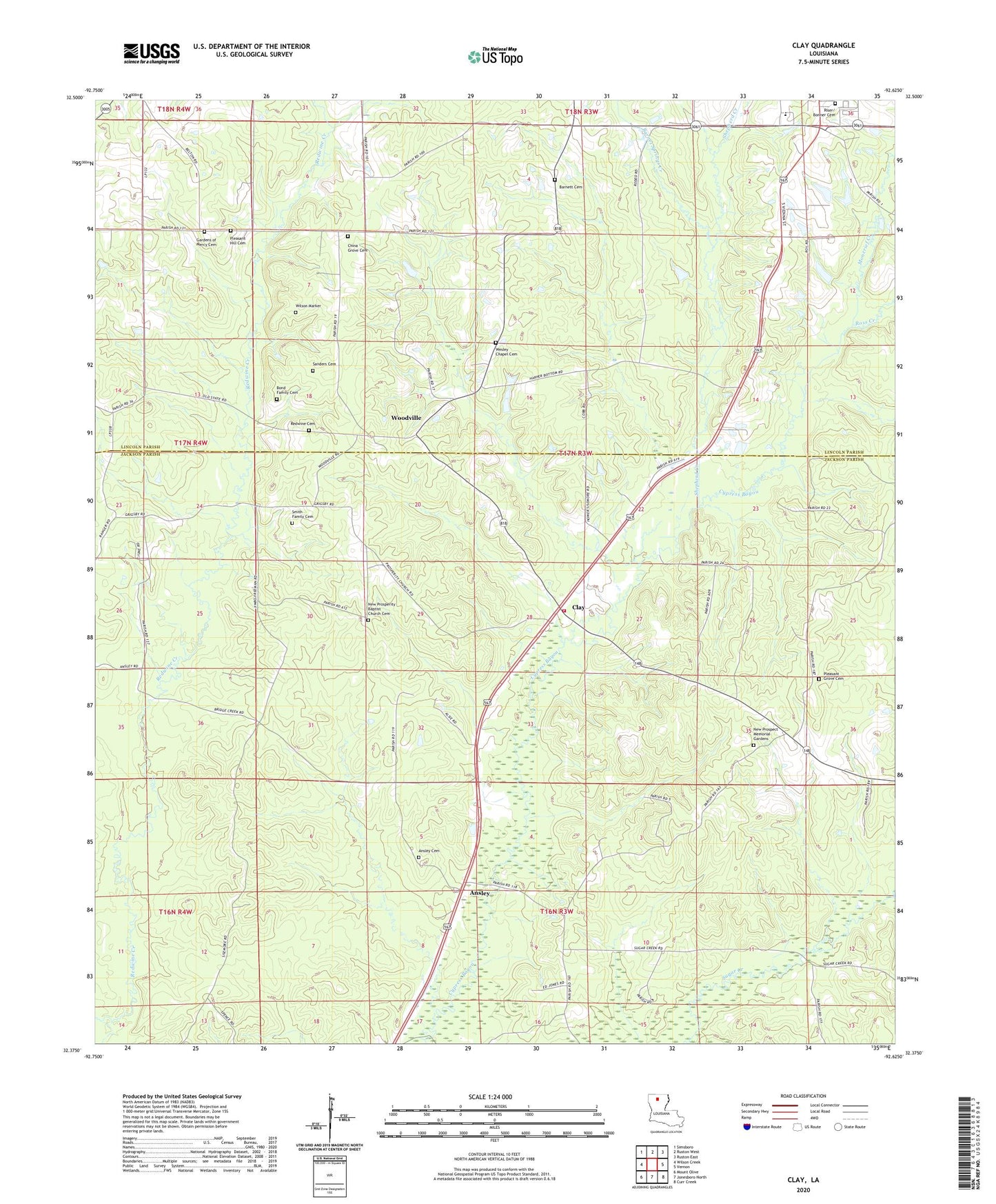
2024 topographic map quadrangle Clay in the state of Louisiana. Scale: 1:24000. Based on the newly updated USGS 7.5' US Topo map series, this map is in the following counties: Jackson, Lincoln. The map contains contour data, water features, and other items you are used to seeing on USGS maps, but also has updated roads and other features. This is the next generation of topographic maps. Printed on high-quality waterproof paper with UV fade-resistant inks.
Quads adjacent to this one:
West: Wilson Creek
Northwest: Simsboro
North: Ruston West
Northeast: Ruston East
East: Vernon
Southeast: Curr Creek
South: Jonesboro North
Southwest: Mount Olive
This map covers the same area as the classic USGS quad with code o32092d6.
Contains the following named places: Ansley, Ansley Cemetery, Ansley Union Church, Barnet Springs Creek, Bethel Baptist Church, Bethel Christian School, Bonner, Clay, Clay Gas Field, Clay Post Office, Edmiston Creek, KXKZ-FM (Ruston), Moncrief Creek, New Prospect Memorial Gardens, New Prosperity Baptist Church Cemetery, Parish Governing Authority District 1, Parish Governing Authority District 11, Parish Governing Authority District 1E, Parish Governing Authority District 1F, Pleasant Grove Church, Pleasant Hill, Pleasant Hill Baptist Church, Prospect Church, Prosperity Baptist Church, Quitman Volunteer Fire Department Station 2, Redwine, Riser / Bonner Cemetery, Ross Creek, Salem Church, Shepherd Creek, Shull, South Parkway Worship Center, Wesley Chapel Cemetery, Wesley Chapel United Methodist Church, Woodville, ZIP Code: 71270