MyTopo
Hog Bayou Louisiana US Topo Map
Couldn't load pickup availability
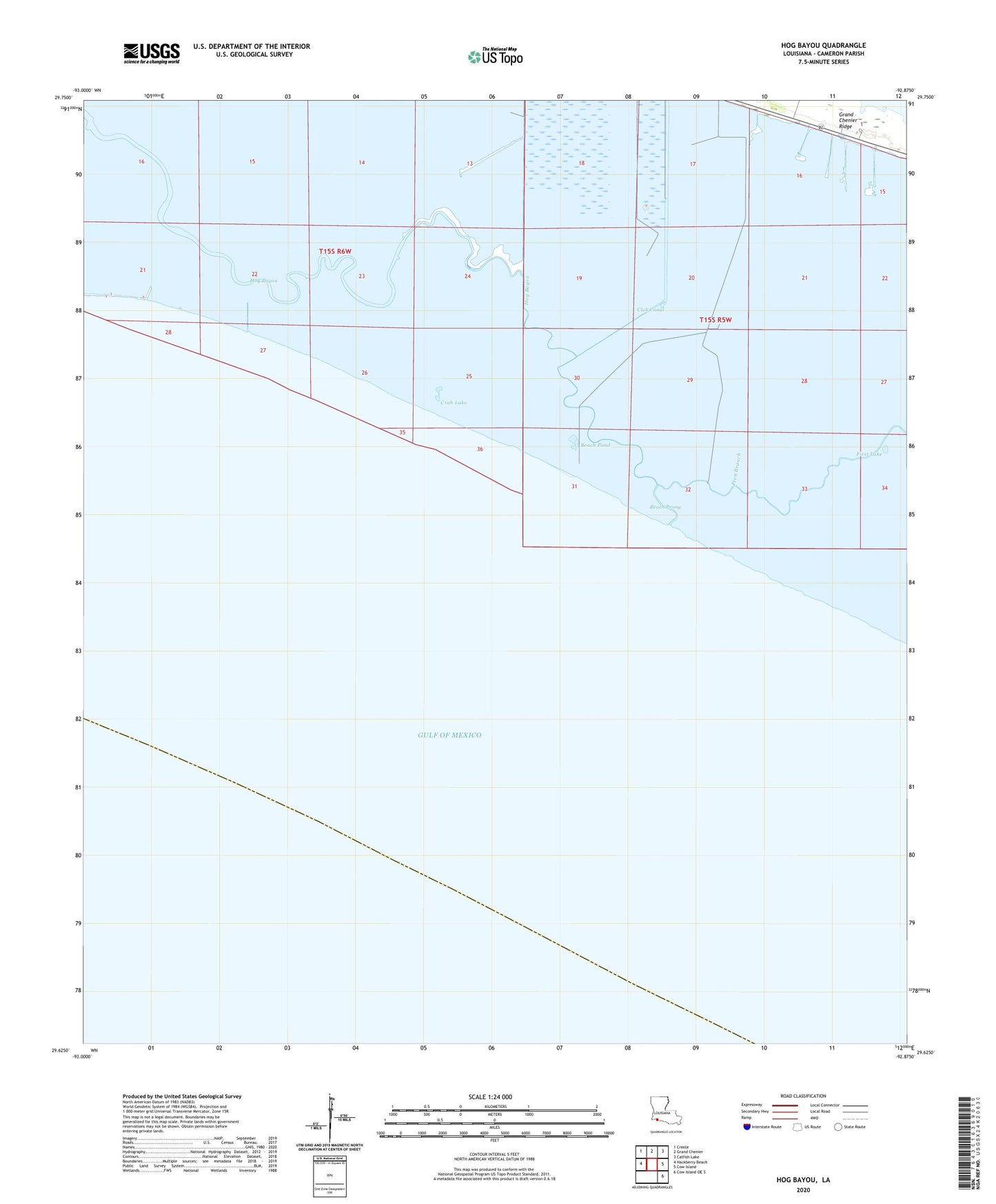
2025 topographic map quadrangle Hog Bayou in the state of Louisiana. Scale: 1:24000. Based on the newly updated USGS 7.5' US Topo map series, this map is in the following counties: Cameron. The map contains contour data, water features, and other items you are used to seeing on USGS maps, but also has updated roads and other features. This is the next generation of topographic maps. Printed on high-quality waterproof paper with UV fade-resistant inks.
Quads adjacent to this one:
West: Hackberry Beach
Northwest: Creole
North: Grand Chenier
Northeast: Catfish Lake
East: Cow Island
Southeast: Cow Island OE S
This map covers the same area as the classic USGS quad with code o29092f8.
Contains the following named places: Beach Pond, Beach Prong, Block Number 4 Gas Field, Club Canal, Crab Lake, Crab Lake Gas Field, First Lake, Grand Chenier Ridge, Hog Bayou, Hog Bayou Oil and Gas Field, Pren Branch, South Grand Chenier Gas Field