MyTopo
Isle au Pitre Louisiana US Topo Map
Couldn't load pickup availability
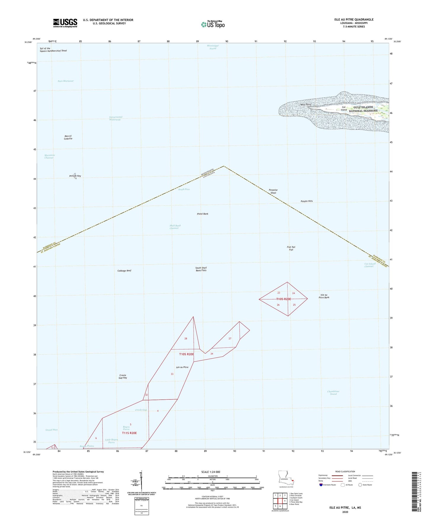
2024 topographic map quadrangle Isle au Pitre in the states of Louisiana, Mississippi. Scale: 1:24000. Based on the newly updated USGS 7.5' US Topo map series, this map is in the following counties: St. Bernard, Harrison. The map contains contour data, water features, and other items you are used to seeing on USGS maps, but also has updated roads and other features. This is the next generation of topographic maps. Printed on high-quality waterproof paper with UV fade-resistant inks.
Quads adjacent to this one:
Northwest: Bay Saint Louis
North: Pass Christian
Northeast: Gulfport South
East: Cat Island
South: Door Point
Southwest: Three Mile Bay
Contains the following named places: Bayou Pierre, Cabbage Reef, Cat Island Channel, Cat Island Lighthouse, Creole Gap, Creole Gap Key, Fish Tail Flat, Grand Pass, Isle au Pitre, Isle au Pitre Bank, Little Bayou Pierre, Marianne Channel, Merrill Coquille, Merrills Shell Bank Lighthouse, North Bank, Pass Marianne, Pelican Key, Pistol Bank, Porpoise Shoal, Potato Hills, Shell Bank Channel, South Pass, South Shell Bank Flats, Tail of the Square Handkerchief Shoal, West Point