MyTopo
Morgan Harbor Louisiana US Topo Map
Couldn't load pickup availability
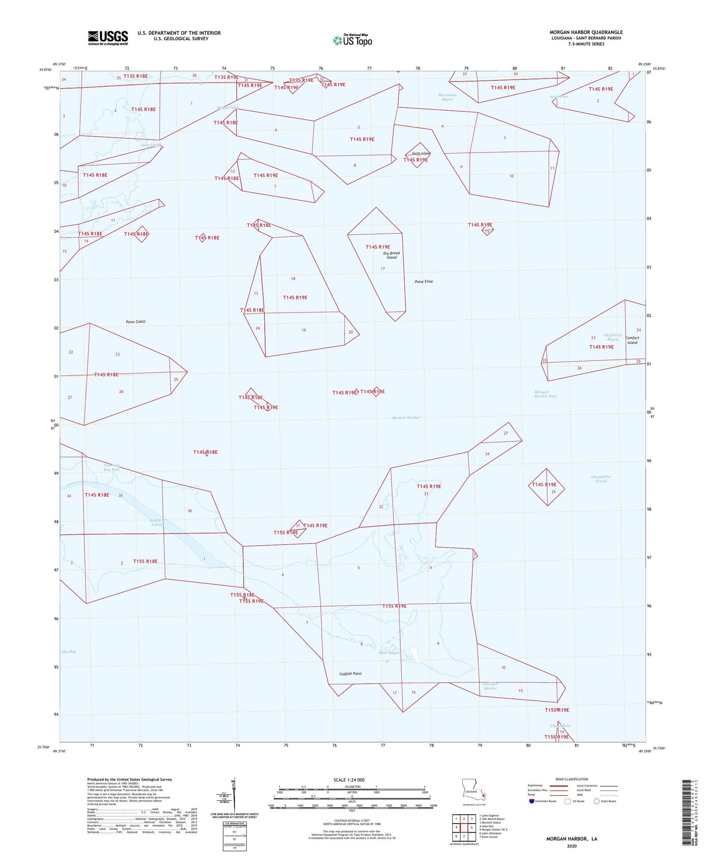
2020 topographic map quadrangle Morgan Harbor in the state of Louisiana. Scale: 1:24000. Based on the newly updated USGS 7.5' US Topo map series, this map is in the following counties: St. Bernard. The map contains contour data, water features, and other items you are used to seeing on USGS maps, but also has updated roads and other features. This is the next generation of topographic maps. Printed on high-quality waterproof paper with UV fade-resistant inks.
Quads adjacent to this one:
West: Lake Eloi
Northwest: Lake Eugenie
North: Oak Mound Bayou
Northeast: Mitchell Island
East: Morgan Harbor OE E
South: Point Chicot
Southwest: Lake Athanasio
Contains the following named places: Bayou Julia, Chandeleur Sound Block 25 Oil Field, Chicot Pass, Christmas Camp Lake, Codfish Point, Dry Bread Island, Eloi Bay, Jules Cutoff, Martinbox Bayou, Morgan Harbor, Morgan Harbor Pass, Old Harry Bayou, Otter Bayou, Point Cahill, Point Eliza, Point Lydia, Point Paulina, Rawhead Island, Scow Pass, Skiff Island, Skiff Lake, Treasure Bay Pass, Treasure Island Gas Field, Twilight Harbor, White Log Lake