MyTopo
Lake Eloi Louisiana US Topo Map
Couldn't load pickup availability
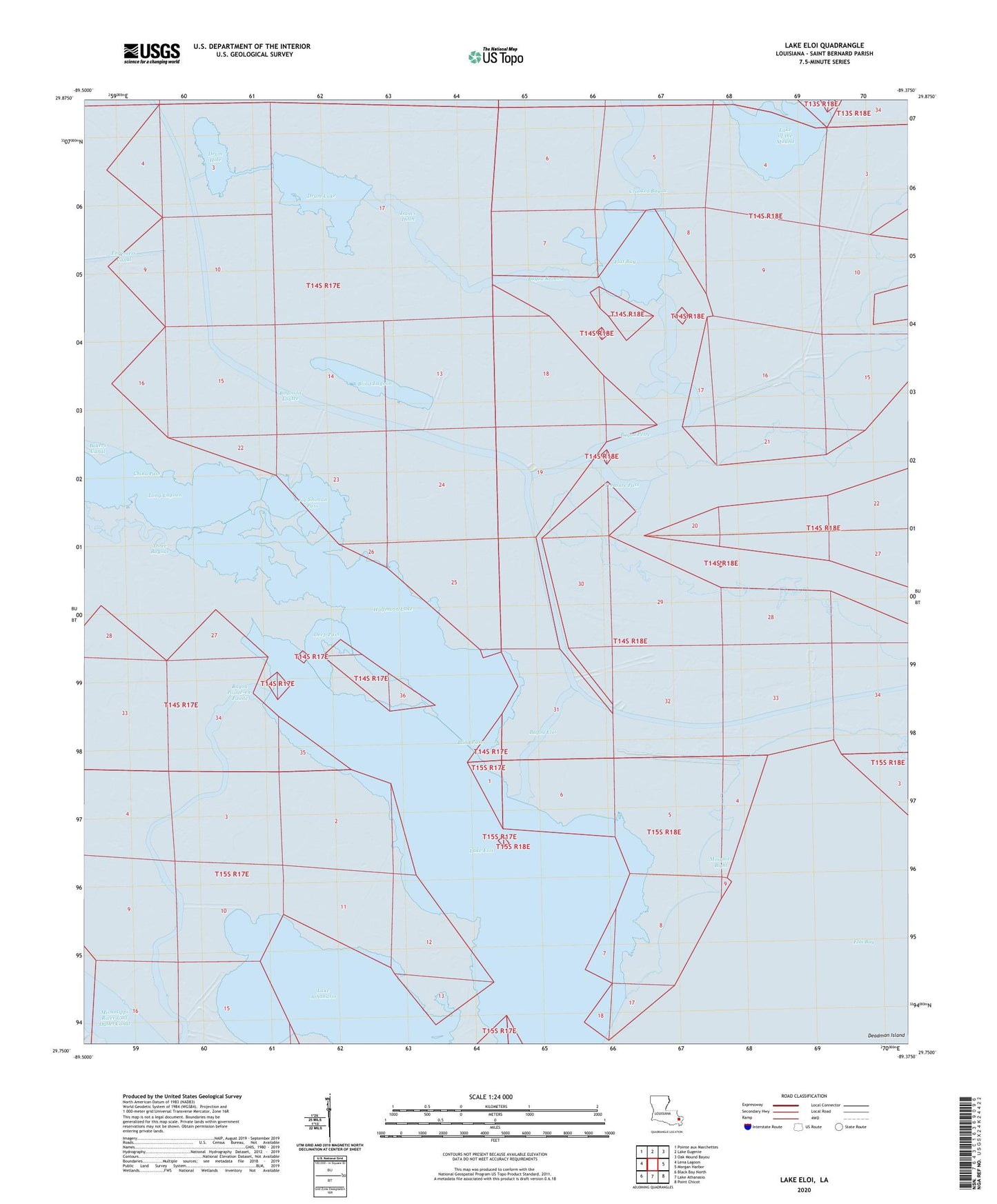
2024 topographic map quadrangle Lake Eloi in the state of Louisiana. Scale: 1:24000. Based on the newly updated USGS 7.5' US Topo map series, this map is in the following counties: St. Bernard. The map contains contour data, water features, and other items you are used to seeing on USGS maps, but also has updated roads and other features. This is the next generation of topographic maps. Printed on high-quality waterproof paper with UV fade-resistant inks.
Quads adjacent to this one:
West: Lena Lagoon
Northwest: Pointe aux Marchettes
North: Lake Eugenie
Northeast: Oak Mound Bayou
East: Morgan Harbor
Southeast: Point Chicot
South: Lake Athanasio
Southwest: Black Bay North
This map covers the same area as the classic USGS quad with code o29089g4.
Contains the following named places: Bakers Canal, Bayou Eloi, Bayou la Loutre, Bayou Petre, Bayou Pointe-en-Pointe, Bayou Ramon, Blind Lagoon, Blind Pass, China Pass, Crooked Bayou, Deep Pass, Drum Hole, Drum Lake, Eloi Bay Oil and Gas Fields, Flat Bay, Greens Bayou, Halfmoon Lake, Isaacs Ditch, Joe Shiman Pass, Lake Eloi, Long Lagoon, Mosquito Bight, Three Bayous, Treasure Bay, Treasure Pass