MyTopo
Point au Fer NE Louisiana US Topo Map
Couldn't load pickup availability
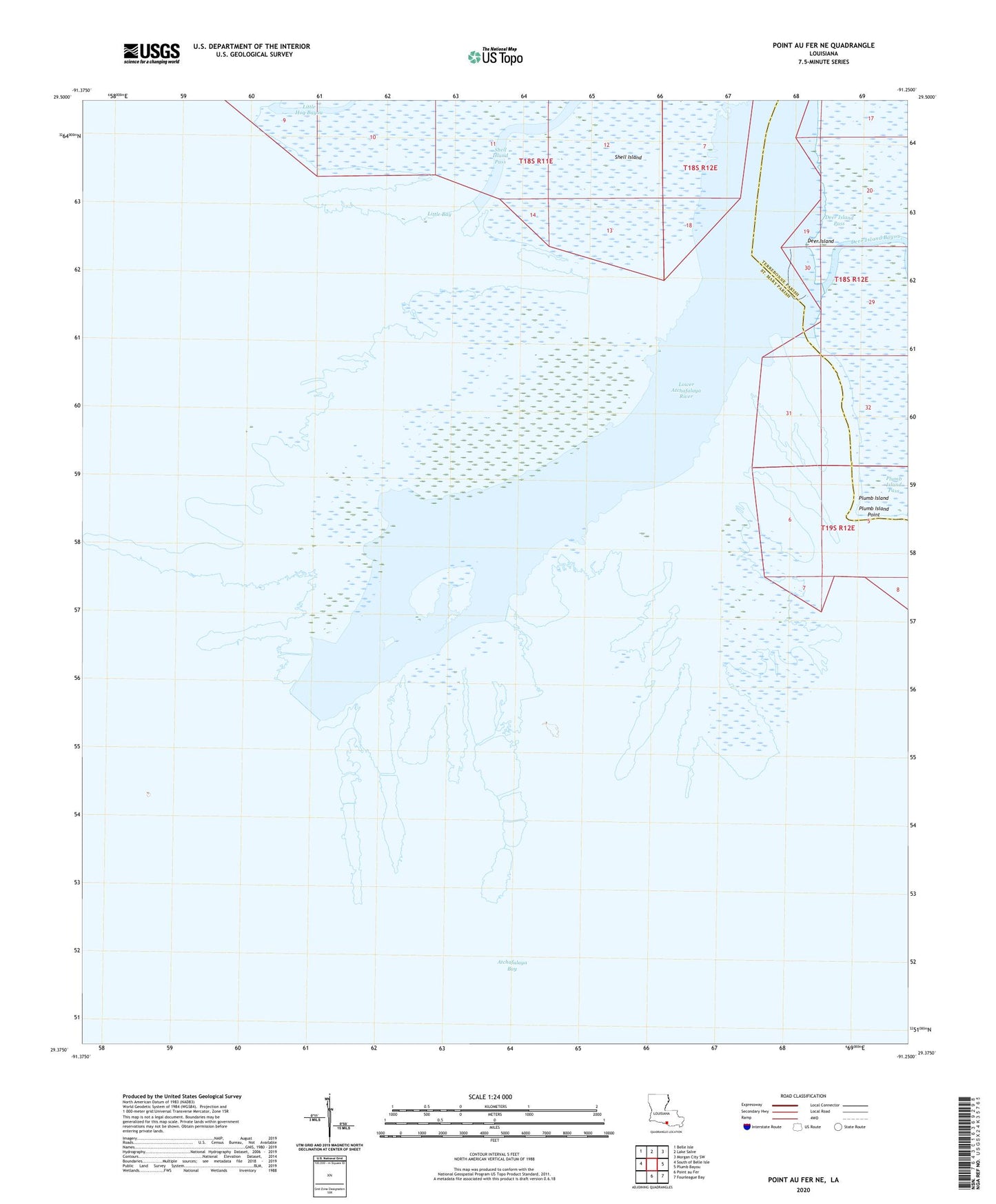
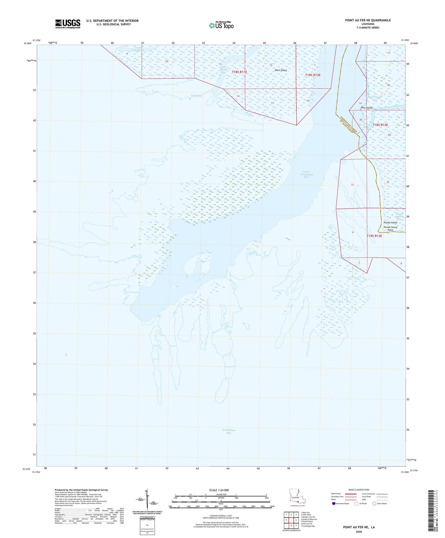
2020 topographic map quadrangle Point au Fer NE in the state of Louisiana. Scale: 1:24000. Based on the newly updated USGS 7.5' US Topo map series, this map is in the following counties: Terrebonne, St. Mary. The map contains contour data, water features, and other items you are used to seeing on USGS maps, but also has updated roads and other features. This is the next generation of topographic maps. Printed on high-quality waterproof paper with UV fade-resistant inks.
Quads adjacent to this one:
West: South of Belle Isle
Northwest: Belle Isle
North: Lake Salve
Northeast: Morgan City SW
East: Plumb Bayou
Southeast: Fourleague Bay
South: Point au Fer
Contains the following named places: Atchafalaya Bay, Atchafalaya Delta State Wildlife Management Area, Deer Island, Deer Island Bayou, Deer Island Pass, Little Bay, Lower Atchafalaya River, Plumb Island, Plumb Island Pass, Plumb Island Point, Round Bayou, Shell Island