MyTopo
Plumb Bayou Louisiana US Topo Map
Couldn't load pickup availability
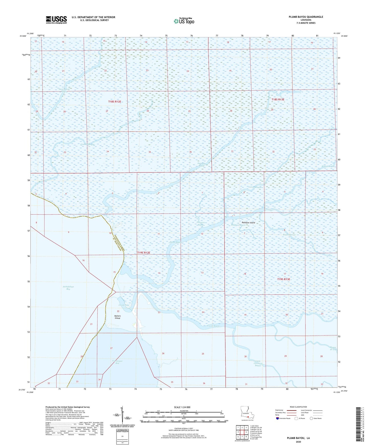
2024 topographic map quadrangle Plumb Bayou in the state of Louisiana. Scale: 1:24000. Based on the newly updated USGS 7.5' US Topo map series, this map is in the following counties: Terrebonne, St. Mary. The map contains contour data, water features, and other items you are used to seeing on USGS maps, but also has updated roads and other features. This is the next generation of topographic maps. Printed on high-quality waterproof paper with UV fade-resistant inks.
Quads adjacent to this one:
West: Point au Fer NE
Northwest: Lake Salve
North: Morgan City SW
Northeast: Morgan City SE
East: Carencro Bayou
Southeast: Lost Lake
South: Fourleague Bay
Southwest: Point au Fer
This map covers the same area as the classic USGS quad with code o29091d2.
Contains the following named places: Bayou de Log, Bayou Sarian, Creole Bayou, Creole Pass, Crooked Bayou, Deer Island Oil and Gas Field, Halters Island, Halters Island Oil and Gas Field, Halters Island Point Light, Little Carencro Bayou, Palmetto Bayou, Palmetto Bayou Oil and Gas Field, Plumb Bayou, Plumb Lake, Prospere Bayou, Rainbow Bayou, Rainbow Island, Victors Bayou, West Deer Island Oil Field, Willow Bayou