MyTopo
Lake Salve Louisiana US Topo Map
Couldn't load pickup availability
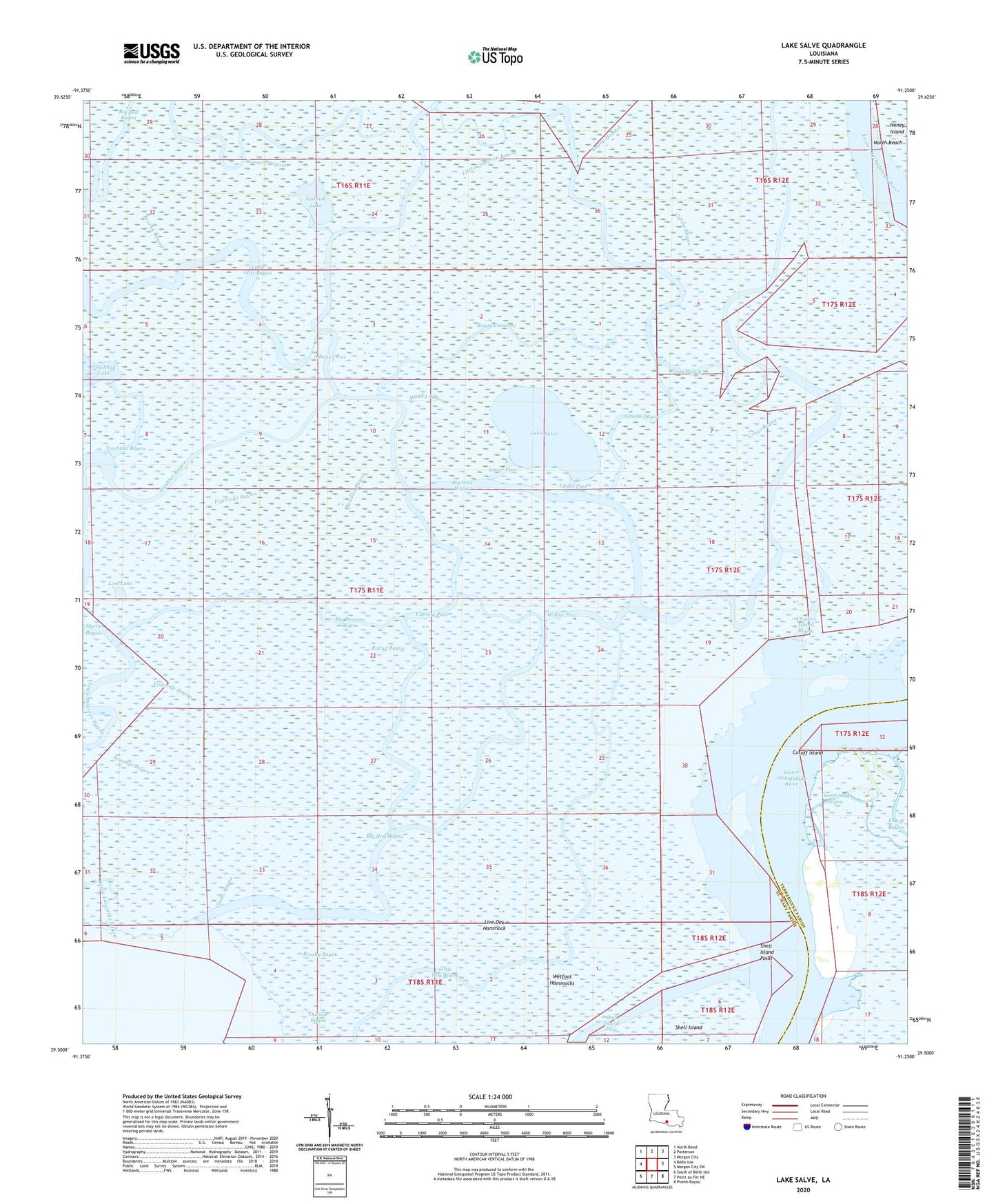
2024 topographic map quadrangle Lake Salve in the state of Louisiana. Scale: 1:24000. Based on the newly updated USGS 7.5' US Topo map series, this map is in the following counties: St. Mary, Terrebonne. The map contains contour data, water features, and other items you are used to seeing on USGS maps, but also has updated roads and other features. This is the next generation of topographic maps. Printed on high-quality waterproof paper with UV fade-resistant inks.
Quads adjacent to this one:
West: Belle Isle
Northwest: North Bend
North: Patterson
Northeast: Morgan City
East: Morgan City SW
Southeast: Plumb Bayou
South: Point au Fer NE
Southwest: South of Belle Isle
This map covers the same area as the classic USGS quad with code o29091e3.
Contains the following named places: Adams Cross, Bateman Lake Gas and Oil Field, Bayou Cameron, Bayou Haydel, Beadles Bayou, Big Bull Bayou, Big Doctors Bayou, Big Hog Bayou, Brushy Bayou, Chicken Island Bayou, Clarks Bayou, Cross Bayou, Cutoff Island, Cypress Pass, Deer Island Bayou, East Bay, Fishtrap Bayou, Fourmile Bayou, Givins Bayou, Grays Bayou, Greens Bayou, Lake Pass Bayou, Lake Salve, Little Adams Cross Bayou, Little Bull Bayou, Little Cameron Bayou, Little Doctors Bayou, Little Hog Bayou, Live Oak Hammock, Lost Lake, Lower Pass, Mire Bayou, Muddy Bayou, Myrtle Bayou, North Beach, Outside Bayou, Round Bayou, Russels Bayou, Sammys Bayou, Shell Island Pass, Shell Island Point, Spanish Lake, Spanish Lake Bayou, Upper Pass, Wetfoot Hammocks, Willow Pass