MyTopo
Reeves Louisiana US Topo Map
Couldn't load pickup availability
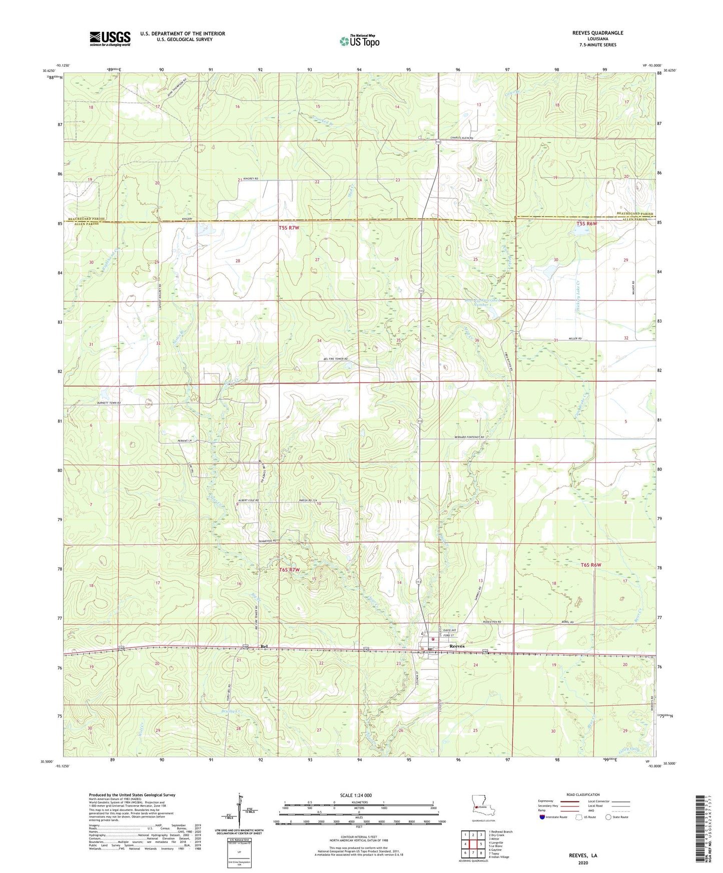
2020 topographic map quadrangle Reeves in the state of Louisiana. Scale: 1:24000. Based on the newly updated USGS 7.5' US Topo map series, this map is in the following counties: Allen, Beauregard. The map contains contour data, water features, and other items you are used to seeing on USGS maps, but also has updated roads and other features. This is the next generation of topographic maps. Printed on high-quality waterproof paper with UV fade-resistant inks.
Quads adjacent to this one:
West: Longville
Northwest: Redhead Branch
North: Dry Creek
Northeast: Mittie
East: Le Blanc
Southeast: Indian Village
South: Topsy
Southwest: Gaytine
Contains the following named places: Austin Branch, Bear Creek Number One Dam, Bear Creek Number Two Dam, Bear Creek Watershed Number 1, Bel, Bel Fire Tower, Bel Lookout Tower, Big Branch, Cane Brake Creek, Mud Creek, Mud Creek Oil Field, North Bell Oil Field, Parish Governing Authority District 7, Reeves, Reeves Bible Church, Reeves High School, Reeves Post Office, Reeves Volunteer Fire Department Allen Parish Ward 3 District 2, Village of Reeves, Ward Three, ZIP Code: 70658