MyTopo
Le Blanc Louisiana US Topo Map
Couldn't load pickup availability
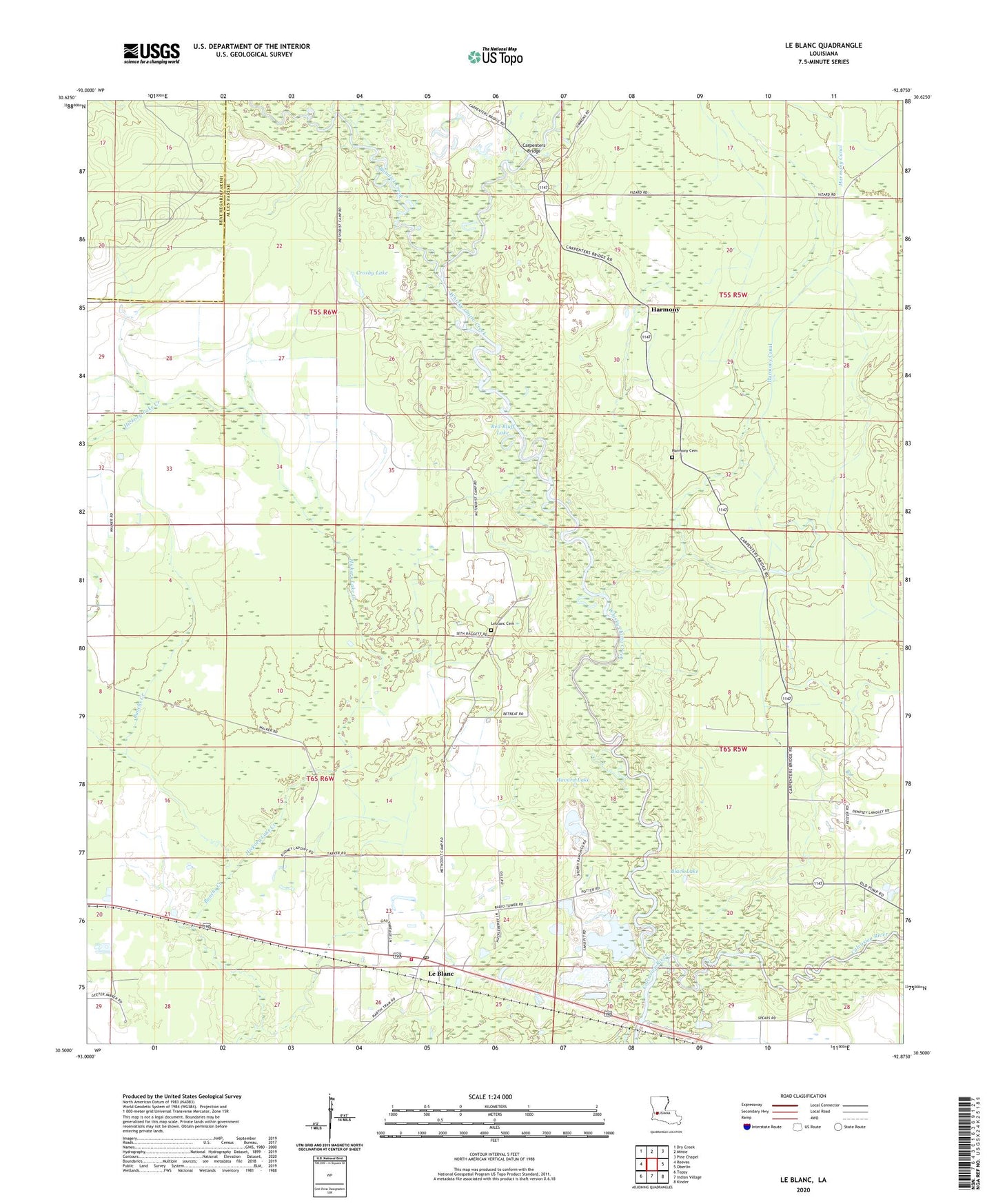
2024 topographic map quadrangle Le Blanc in the state of Louisiana. Scale: 1:24000. Based on the newly updated USGS 7.5' US Topo map series, this map is in the following counties: Allen, Beauregard. The map contains contour data, water features, and other items you are used to seeing on USGS maps, but also has updated roads and other features. This is the next generation of topographic maps. Printed on high-quality waterproof paper with UV fade-resistant inks.
Quads adjacent to this one:
West: Reeves
Northwest: Dry Creek
North: Mittie
Northeast: Pine Chapel
East: Oberlin
Southeast: Kinder
South: Indian Village
Southwest: Topsy
This map covers the same area as the classic USGS quad with code o30092e8.
Contains the following named places: Bear Creek Number Three Dam, Black Lake, Bunchs Creek Oil and Gas Field, Bundick Creek, Carpenters Bridge, Crosby Lake, Harmony, Harmony Canal, Harmony Church Oil Field, Havard Lake, Hickory Lake Creek, Le Blanc, Le Blanc Church, Le Blanc Oil Field, Le Blanc Post Office, LeBlanc Volunteer Fire Department, Louisiana Noname 78 Dam, Prairie Creek, Red Bluff Lake, United Methodist Camp, Whisky Chitto Creek, ZIP Codes: 70648, 70651